Zghartā geodata
Zghartā (Liban-Nord) is a seat of a second-order administrative division; located in Lebanon in Asia/Beirut (GMT+3) time zone. In our database, there are 19 cities with bigger population. Compared to other cities in Lebanon, 93.8% of cities are located further ↓South; 78.1% of cities are located further ←West and 68.7% of cities have higher elevation than Zghartā. Note1


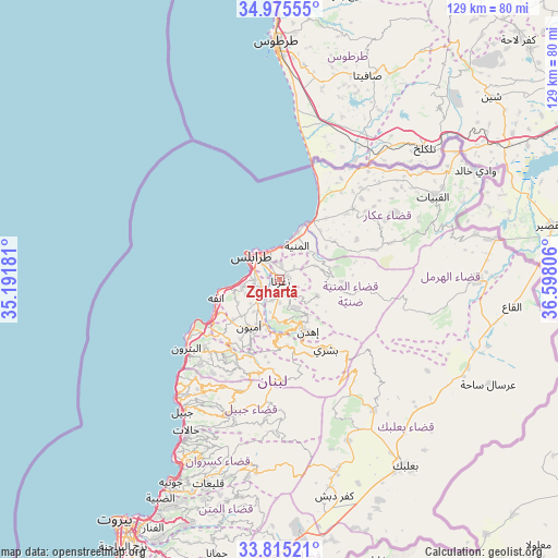
Zghartā GPS coordinates[2]
34° 23' 50.604" North, 35° 53' 41.748" East
| Map corner | latitude | longitude |
|---|---|---|
| Upper-left | 34.97555°, | 35.19181° |
| Center: | 34.39739°, | 35.89493° |
| Lower-right: | 33.81521°, | 36.59806° |
| Map W x H: | 129×129 km | = 80.2×80.2mi |
| max Lat: | 34.54278° ⇑6.2% North |
| Zghartā: | 34.39739° |
| min Lat: | ⇓93.8% South 33.11023° |
| min Long | Zghartā | max Long |
| 35.13972° | 35.89493° | 36.38472° |
| W 78.1%⇐ | ⇒21.9% E |
Elevation
Elevation of Zghartā is 126 m = 413 ft, and this is 429.2 m = 1408 ft below average elevation for this country.
| Max E: |
1442 m = 4731 ft | 68.7% |
| Avg. | 555.2 m = 1822 ft | |
| Zghartā | 126 m = 413 ft | |
Min E: |
7 m = 23 ft | 31.3% |
See also: Lebanon elevation on elevation.city.
Geographical zone
Zghartā is located in North temperate zone (between Tropic of Cancer and the Arctic Circle). Distance of this Northern Tropic circle is 1218.7 km =757.3 mi to South.| Distance of | km | miles | from Zghartā |
|---|---|---|---|
| North Pole | 6182.4 | 3841.6 | to North |
| Arctic Circle | 3576.5 | 2222.3 | to North |
| Tropic Cancer | 1218.7 | 757.3 | to South |
| Equator | 3824.6 | 2376.5 | to South |


Nearby cities:
15 places around Zghartā: (largest is in red/bold)
• Amioûn
13.4 km =8.3 mi,  216°
216°
• Baalbek
52.7 km =32.7 mi,  145°
145°
• Batroûn
26.9 km =16.7 mi,  234°
234°
• Bcharré
19.4 km =12.1 mi, 146°
• Beirut
66.7 km =41.4 mi,  212°
212°
• Bhamdoûn el Mhatta
69 km =42.9 mi,  198°
198°
• El Hermel
44.9 km =27.9 mi,  90°
90°
• Halba
23.4 km =14.5 mi,  46°
46°
• Jbaïl
38.2 km =23.7 mi, 216°
• Jdaidet el Matn
64 km =39.8 mi, 208°
• Jounieh
52.9 km =32.9 mi, 208°
• Ra’s Bayrūt
67 km =41.6 mi, 214°
• Sîr ed Danniyé
12.6 km =7.8 mi,  96°
96°
• Tripoli
6.2 km =3.9 mi,  310°
310°
• Zahlé
61.2 km =38 mi,  179°
179°
Sources, notices
• [Note1] Compared only with cities in Lebanon existing in our database
• [Src1] Map data: © OpenStreetMap contributors (CC-BY-SA)
• [Src2] Other city data from geonames.org with taken over terms of usage.
• [Src3] Geographical zone / Annual Mean Temperature by Robert A. Rohde @ Wikipedia
