Peliyagoda geodata
Peliyagoda (Western) is a populated place; located in Sri Lanka in Asia/Colombo (GMT+5.5) time zone. With population of 30,717 people, there are 39 cities with bigger population in this country. Compared to other cities in Sri Lanka, 51.3% of cities are located further ↓South; 90.8% of cities are located further →East and 92.1% of cities have higher elevation than Peliyagoda. Note1
Administrative division(s):
- Level 1: Western
- Level 2: Gampaha District
- Level 3: Kelaniya Division
- Level 4: Peliyagodawatta


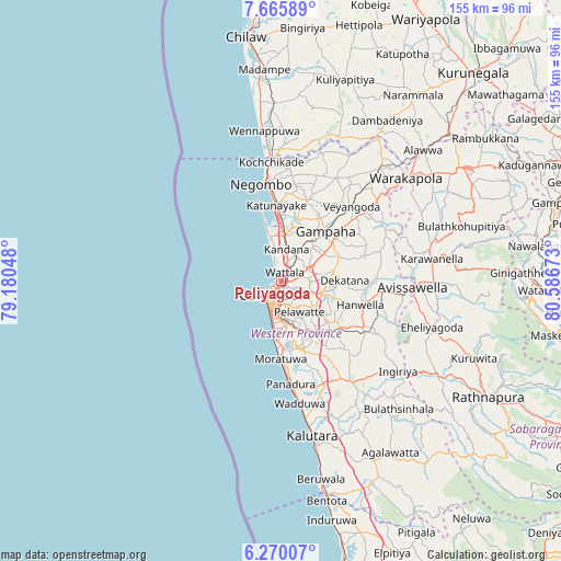
Peliyagoda GPS coordinates[2]
6° 58' 6.6" North, 79° 53' 0.96" East
| Map corner | latitude | longitude |
|---|---|---|
| Upper-left | 7.66589°, | 79.18048° |
| Center: | 6.9685°, | 79.8836° |
| Lower-right: | 6.27007°, | 80.58673° |
| Map W x H: | 155.2×155.2 km | = 96.4×96.4mi |
| max Lat: | 9.81667° ⇑48.7% North |
| Peliyagoda: | 6.9685° |
| min Lat: | ⇓51.3% South 5.92825° |
| min Long | Peliyagoda | max Long |
| 79.79528° | 79.8836° | 81.83472° |
| W 9.2%⇐ | ⇒90.8% E |
Elevation
Elevation of Peliyagoda is 7 m = 23 ft, and this is 150.4 m = 493 ft below average elevation for this country.
| Max E: |
1868 m = 6129 ft | 92.1% |
| Avg. | 157.4 m = 516 ft | |
| Peliyagoda | 7 m = 23 ft | |
Min E: |
1 m = 3 ft | 7.9% |
See also: Sri Lanka elevation on elevation.city.
Geographical zone
Peliyagoda is located in North Torrid zone (between Equator and Tropic of Cancer). Distance of Equator is 774.8 km =481.4 mi to South.| Distance of | km | miles | from Peliyagoda |
|---|---|---|---|
| North Pole | 9232.2 | 5736.6 | to North |
| Arctic Circle | 6626.3 | 4117.4 | to North |
| Tropic Cancer | 1831.1 | 1137.8 | to North |
| Equator | 774.8 | 481.4 | to South |


Nearby cities:
15 places around Peliyagoda: (largest is in red/bold)
• Battaramulla South
8.9 km =5.5 mi,  154°
154°
• Colombo
5.3 km =3.3 mi,  226°
226°
• Dehiwala-Mount Lavinia
14.3 km =8.9 mi,  185°
185°
• Hendala
2.5 km =1.6 mi,  358°
358°
• Ja Ela
11.8 km =7.3 mi,  4°
4°
• Kandana
8.9 km =5.5 mi,  7°
7°
• Kelaniya
4.5 km =2.8 mi,  109°
109°
• Kolonnawa
4 km =2.5 mi,  178°
178°
• Kotikawatta
5.4 km =3.4 mi, 148°
• Maharagama
14.2 km =8.8 mi,  160°
160°
• Mulleriyawa
6.4 km =4 mi,  127°
127°
• Pita Kotte
8.9 km =5.5 mi,  167°
167°
• Sri Jayewardenepura Kotte
9.9 km =6.2 mi, 164°
• Wattala
2.5 km =1.6 mi,  21°
21°
• Welisara
6.9 km =4.3 mi, 16°
Sources, notices
• [Note1] Compared only with cities in Sri Lanka existing in our database
• [Src1] Map data: © OpenStreetMap contributors (CC-BY-SA)
• [Src2] Other city data from geonames.org with taken over terms of usage.
• [Src3] Geographical zone / Annual Mean Temperature by Robert A. Rohde @ Wikipedia
