Kolonnawa geodata
Kolonnawa (Western) is a populated place; located in Sri Lanka in Asia/Colombo (GMT+5.5) time zone. With population of 58,076 people, there are 22 cities with bigger population in this country. Compared to other cities in Sri Lanka, 55.3% of cities are located further ↑North; 89.5% of cities are located further →East and 55.3% of cities have lower elevation than Kolonnawa. Note1
Administrative division(s):
- Level 1: Western
- Level 2: Colombo District
- Level 3: Kolonnawa Division
- Level 4: Kolonnawa


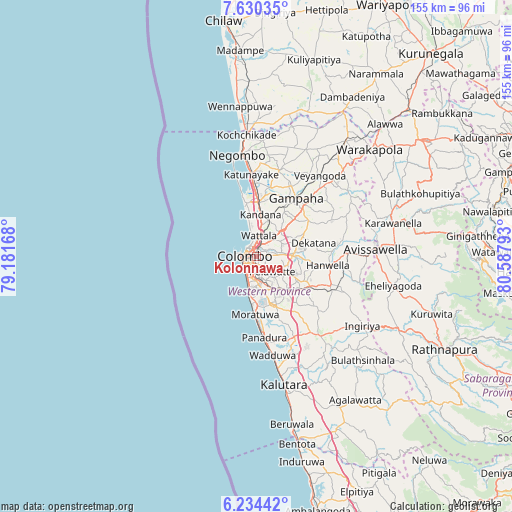
Kolonnawa GPS coordinates[2]
6° 55' 58.44" North, 79° 53' 5.28" East
| Map corner | latitude | longitude |
|---|---|---|
| Upper-left | 7.63035°, | 79.18168° |
| Center: | 6.9329°, | 79.8848° |
| Lower-right: | 6.23442°, | 80.58793° |
| Map W x H: | 155.2×155.2 km | = 96.4×96.4mi |
| max Lat: | 9.81667° ⇑55.3% North |
| Kolonnawa: | 6.9329° |
| min Lat: | ⇓44.7% South 5.92825° |
| min Long | Kolonnawa | max Long |
| 79.79528° | 79.8848° | 81.83472° |
| W 10.5%⇐ | ⇒89.5% E |
Elevation
Elevation of Kolonnawa is 20 m = 66 ft, and this is 137.4 m = 451 ft below average elevation for this country.
| Max E: |
1868 m = 6129 ft | 44.7% |
| Avg. | 157.4 m = 516 ft | |
| Kolonnawa | 20 m = 66 ft | |
Min E: |
1 m = 3 ft | 55.3% |
See also: Kolonnawa elevation on elevation.city.
Geographical zone
Kolonnawa is located in North Torrid zone (between Equator and Tropic of Cancer). Distance of Equator is 770.9 km =479 mi to South.| Distance of | km | miles | from Kolonnawa |
|---|---|---|---|
| North Pole | 9236.2 | 5739.1 | to North |
| Arctic Circle | 6630.3 | 4119.9 | to North |
| Tropic Cancer | 1835.1 | 1140.3 | to North |
| Equator | 770.9 | 479 | to South |


Nearby cities:
15 places around Kolonnawa: (largest is in red/bold)
• Battaramulla South
5.5 km =3.4 mi,  137°
137°
• Colombo
4 km =2.5 mi,  274°
274°
• Dehiwala-Mount Lavinia
10.4 km =6.5 mi,  188°
188°
• Hendala
6.5 km =4 mi,  358°
358°
• Ja Ela
15.8 km =9.8 mi,  2°
2°
• Kandana
12.8 km =8 mi, 4°
• Kelaniya
4.8 km =3 mi,  58°
58°
• Kotikawatta
2.8 km =1.7 mi,  103°
103°
• Maharagama
10.5 km =6.5 mi,  154°
154°
• Mulleriyawa
5 km =3.1 mi,  89°
89°
• Peliyagoda
4 km =2.5 mi, 358°
• Pita Kotte
5.1 km =3.2 mi,  158°
158°
• Sri Jayewardenepura Kotte
6.1 km =3.8 mi, 156°
• Wattala
6.3 km =3.9 mi,  6°
6°
• Welisara
10.7 km =6.6 mi, 9°
Sources, notices
• [Note1] Compared only with cities in Sri Lanka existing in our database
• [Src1] Map data: © OpenStreetMap contributors (CC-BY-SA)
• [Src2] Other city data from geonames.org with taken over terms of usage.
• [Src3] Geographical zone / Annual Mean Temperature by Robert A. Rohde @ Wikipedia
