Veisiejai geodata
Veisiejai (Alytus) is a populated place; located in Lithuania in Europe/Vilnius (GMT+3) time zone. With population of 1,654 people, there are 102 cities with bigger population in this country. Compared to other cities in Lithuania, 99.3% of cities are located further ↑North; 59% of cities are located further →East and 71.6% of cities have lower elevation than Veisiejai. Note1


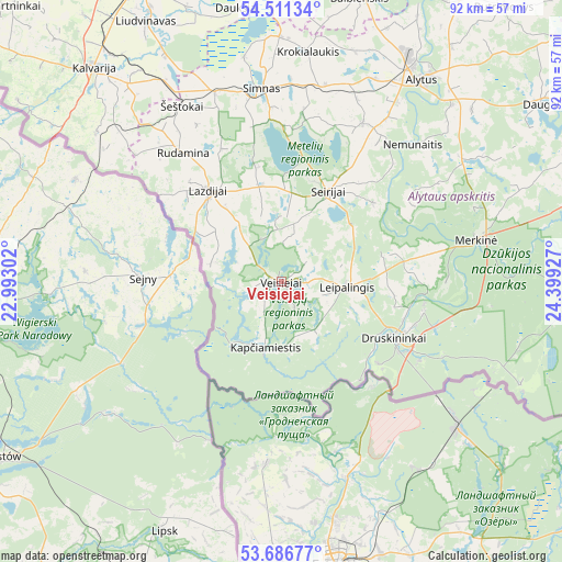
Veisiejai GPS coordinates[2]
54° 6' 3.96" North, 23° 41' 46.104" East
| Map corner | latitude | longitude |
|---|---|---|
| Upper-left | 54.51134°, | 22.99302° |
| Center: | 54.1011°, | 23.69614° |
| Lower-right: | 53.68677°, | 24.39927° |
| Map W x H: | 91.7×91.7 km | = 57×57mi |
| max Lat: | 56.36149° ⇑99.3% North |
| Veisiejai: | 54.1011° |
| min Lat: | ⇓0.7% South 54.01573° |
| min Long | Veisiejai | max Long |
| 20.99651° | 23.69614° | 26.43984° |
| W 41%⇐ | ⇒59% E |
Elevation
Elevation of Veisiejai is 119 m = 390 ft, and this is 28.3 m = 93 ft above average elevation for this country.
| Max E: |
204 m = 669 ft | 28.4% |
| Veisiejai | 119 m 390 ft | |
| Avg. | 90.7 m = 298 ft | |
Min E: |
-1 m = -3 ft | 71.6% |
See also: Lithuania elevation on elevation.city.
Geographical zone
Veisiejai is located in North temperate zone (between Tropic of Cancer and the Arctic Circle). Distance of this North polar circle is 1385.7 km =861 mi to North.| Distance of | km | miles | from Veisiejai |
|---|---|---|---|
| North Pole | 3991.6 | 2480.3 | to North |
| Arctic Circle | 1385.7 | 861 | to North |
| Tropic Cancer | 3409.6 | 2118.6 | to South |
| Equator | 6015.5 | 3737.9 | to South |


Nearby cities:
15 places around Veisiejai: (largest is in red/bold)
• Alytus
39.8 km =24.7 mi,  34°
34°
• Aukstadvaris
75.7 km =47 mi,  45°
45°
• Birštonas
60.5 km =37.6 mi,  21°
21°
• Daugai
50.9 km =31.6 mi, 54°
• Druskininkai
21.2 km =13.2 mi,  116°
116°
• Jieznas
63.5 km =39.5 mi, 29°
• Kalvarija
46.7 km =29 mi,  318°
318°
• Kazlų Rūda
73.3 km =45.5 mi,  349°
349°
• Lazdijai
18.9 km =11.7 mi, 321°
• Linksmakalnis
74.6 km =46.4 mi,  11°
11°
• Marijampolė
55.6 km =34.5 mi,  336°
336°
• Prienai
61.6 km =38.3 mi, 15°
• Simnas
31.4 km =19.5 mi, 354°
• Varėna
58.6 km =36.4 mi,  77°
77°
• Vilkaviskis
74.8 km =46.5 mi, 324°
Sources, notices
• [Note1] Compared only with cities in Lithuania existing in our database
• [Src1] Map data: © OpenStreetMap contributors (CC-BY-SA)
• [Src2] Other city data from geonames.org with taken over terms of usage.
• [Src3] Geographical zone / Annual Mean Temperature by Robert A. Rohde @ Wikipedia
