Dotnuva geodata
Dotnuva (Kaunas) is a populated place; located in Lithuania in Europe/Vilnius (GMT+3) time zone. With population of 783 people, there are 128 cities with bigger population in this country. Compared to other cities in Lithuania, 60.4% of cities are located further ↓South; 52.2% of cities are located further →East and 75.4% of cities have higher elevation than Dotnuva. Note1


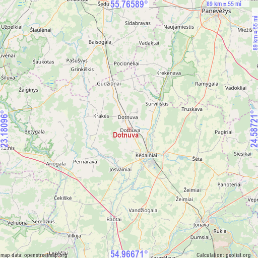
Dotnuva GPS coordinates[2]
55° 22' 5.952" North, 23° 53' 2.688" East
| Map corner | latitude | longitude |
|---|---|---|
| Upper-left | 55.76589°, | 23.18096° |
| Center: | 55.36832°, | 23.88408° |
| Lower-right: | 54.96671°, | 24.58721° |
| Map W x H: | 88.9×88.9 km | = 55.2×55.2mi |
| max Lat: | 56.36149° ⇑39.6% North |
| Dotnuva: | 55.36832° |
| min Lat: | ⇓60.4% South 54.01573° |
| min Long | Dotnuva | max Long |
| 20.99651° | 23.88408° | 26.43984° |
| W 47.8%⇐ | ⇒52.2% E |
Elevation
Elevation of Dotnuva is 59 m = 194 ft, and this is 31.7 m = 104 ft below average elevation for this country.
| Max E: |
204 m = 669 ft | 75.4% |
| Avg. | 90.7 m = 298 ft | |
| Dotnuva | 59 m = 194 ft | |
Min E: |
-1 m = -3 ft | 24.6% |
See also: Lithuania elevation on elevation.city.
Geographical zone
Dotnuva is located in North temperate zone (between Tropic of Cancer and the Arctic Circle). Distance of this North polar circle is 1244.8 km =773.5 mi to North.| Distance of | km | miles | from Dotnuva |
|---|---|---|---|
| North Pole | 3850.7 | 2392.7 | to North |
| Arctic Circle | 1244.8 | 773.5 | to North |
| Tropic Cancer | 3550.5 | 2206.2 | to South |
| Equator | 6156.4 | 3825.4 | to South |


Nearby cities:
15 places around Dotnuva: (largest is in red/bold)
• Ariogala
28.3 km =17.6 mi,  245°
245°
• Eiguliai
48.7 km =30.3 mi,  176°
176°
• Jonava
40.6 km =25.2 mi,  141°
141°
• Karmėlava
45.6 km =28.3 mi,  165°
165°
• Kačerginė
49.5 km =30.8 mi,  192°
192°
• Kulautuva
49.8 km =30.9 mi,  197°
197°
• Kėdainiai
10.6 km =6.6 mi,  147°
147°
• Naujamiestis
39.3 km =24.4 mi,  25°
25°
• Ramučiai
47.6 km =29.6 mi, 168°
• Ramygala
30.8 km =19.1 mi,  58°
58°
• Raseiniai
48 km =29.8 mi,  271°
271°
• Sargėnai
46.6 km =29 mi, 180°
• Vilkija
40.5 km =25.2 mi,  207°
207°
• Šeduva
43.1 km =26.8 mi,  349°
349°
• Šilainiai
48.8 km =30.3 mi, 179°
Sources, notices
• [Note1] Compared only with cities in Lithuania existing in our database
• [Src1] Map data: © OpenStreetMap contributors (CC-BY-SA)
• [Src2] Other city data from geonames.org with taken over terms of usage.
• [Src3] Geographical zone / Annual Mean Temperature by Robert A. Rohde @ Wikipedia
