Naujamiestis geodata
Naujamiestis (Panevėžys) is a populated place; located in Lithuania in Europe/Vilnius (GMT+3) time zone. With population of 770 people, there are 129 cities with bigger population in this country. Compared to other cities in Lithuania, 71.6% of cities are located further ↓South; 59% of cities are located further ←West and 83.6% of cities have higher elevation than Naujamiestis. Note1


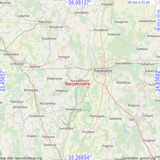
Naujamiestis GPS coordinates[2]
55° 41' 12.876" North, 24° 9' 13.284" East
| Map corner | latitude | longitude |
|---|---|---|
| Upper-left | 56.08127°, | 23.45057° |
| Center: | 55.68691°, | 24.15369° |
| Lower-right: | 55.28854°, | 24.85682° |
| Map W x H: | 88.1×88.1 km | = 54.7×54.7mi |
| max Lat: | 56.36149° ⇑28.4% North |
| Naujamiestis: | 55.68691° |
| min Lat: | ⇓71.6% South 54.01573° |
| min Long | Naujamiestis | max Long |
| 20.99651° | 24.15369° | 26.43984° |
| W 59%⇐ | ⇒41% E |
Elevation
Elevation of Naujamiestis is 49 m = 161 ft, and this is 41.7 m = 137 ft below average elevation for this country.
| Max E: |
204 m = 669 ft | 83.6% |
| Avg. | 90.7 m = 298 ft | |
| Naujamiestis | 49 m = 161 ft | |
Min E: |
-1 m = -3 ft | 16.4% |
See also: Lithuania elevation on elevation.city.
Geographical zone
Naujamiestis is located in North temperate zone (between Tropic of Cancer and the Arctic Circle). Distance of this North polar circle is 1209.4 km =751.5 mi to North.| Distance of | km | miles | from Naujamiestis |
|---|---|---|---|
| North Pole | 3815.3 | 2370.7 | to North |
| Arctic Circle | 1209.4 | 751.5 | to North |
| Tropic Cancer | 3585.9 | 2228.2 | to South |
| Equator | 6191.8 | 3847.4 | to South |


Nearby cities:
15 places around Naujamiestis: (largest is in red/bold)
• Dotnuva
39.3 km =24.4 mi,  205°
205°
• Kavarskas
56.2 km =34.9 mi,  120°
120°
• Kupiskis
54.4 km =33.8 mi,  71°
71°
• Kėdainiai
45.8 km =28.5 mi,  194°
194°
• Linkuva
45.8 km =28.5 mi,  345°
345°
• Pakruojis
37.4 km =23.2 mi,  330°
330°
• Panevėžys
13.3 km =8.3 mi, 67°
• Pasvalys
44.3 km =27.5 mi,  20°
20°
• Radviliskis
41.4 km =25.7 mi,  290°
290°
• Ramygala
21.3 km =13.2 mi,  154°
154°
• Tytuvėnėliai
62 km =38.5 mi,  263°
263°
• Ukmerge
61.4 km =38.2 mi,  142°
142°
• Vabalninkas
49.5 km =30.8 mi,  48°
48°
• Šeduva
25.8 km =16 mi, 285°
• Šiauliai
59 km =36.7 mi,  297°
297°
Sources, notices
• [Note1] Compared only with cities in Lithuania existing in our database
• [Src1] Map data: © OpenStreetMap contributors (CC-BY-SA)
• [Src2] Other city data from geonames.org with taken over terms of usage.
• [Src3] Geographical zone / Annual Mean Temperature by Robert A. Rohde @ Wikipedia
