Diekirch geodata
Diekirch is a seat of a first-order administrative division; located in Luxembourg in Europe/Luxembourg (GMT+2) time zone. With population of 6,242 people, there are 7 cities with bigger population in this country. Compared to other cities in Luxembourg, 89.8% of cities are located further ↓South; 63.3% of cities are located further ←West and 88.1% of cities have higher elevation than Diekirch. Note1


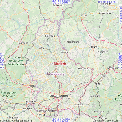
Diekirch GPS coordinates[2]
49° 52' 4.008" North, 6° 9' 20.988" East
| Map corner | latitude | longitude |
|---|---|---|
| Upper-left | 50.31886°, | 5.45271° |
| Center: | 49.86778°, | 6.15583° |
| Lower-right: | 49.41245°, | 6.85896° |
| Map W x H: | 100.8×100.8 km | = 62.6×62.6mi |
| max Lat: | 50.13722° ⇑10.2% North |
| Diekirch: | 49.86778° |
| min Lat: | ⇓89.8% South 49.45964° |
| min Long | Diekirch | max Long |
| 5.76583° | 6.15583° | 6.50532° |
| W 63.3%⇐ | ⇒36.7% E |
Elevation
Elevation of Diekirch is 195 m = 640 ft, and this is 87 m = 285 ft below average elevation for this country.
| Max E: |
502 m = 1647 ft | 88.1% |
| Avg. | 282 m = 925 ft | |
| Diekirch | 195 m = 640 ft | |
Min E: |
143 m = 469 ft | 11.9% |
See also: Luxembourg elevation on elevation.city.
Geographical zone
Diekirch is located in North temperate zone (between Tropic of Cancer and the Arctic Circle). Distance of this North polar circle is 1856.4 km =1153.5 mi to North.| Distance of | km | miles | from Diekirch |
|---|---|---|---|
| North Pole | 4462.3 | 2772.7 | to North |
| Arctic Circle | 1856.4 | 1153.5 | to North |
| Tropic Cancer | 2938.9 | 1826.1 | to South |
| Equator | 5544.8 | 3445.4 | to South |


Nearby cities:
15 places around Diekirch: (largest is in red/bold)
• Bettendorf
4.6 km =2.9 mi,  77°
77°
• Bourscheid
7.8 km =4.8 mi,  305°
305°
• Colmar
7.7 km =4.8 mi,  213°
213°
• Erpeldange
3 km =1.9 mi,  263°
263°
• Ettelbruck
4.3 km =2.7 mi,  238°
238°
• Gilsdorf
1.7 km =1.1 mi,  100°
100°
• Ingeldorf
2.3 km =1.4 mi,  220°
220°
• Medernach
7.7 km =4.8 mi,  146°
146°
• Niederfeulen
7.9 km =4.9 mi, 260°
• Nommern
9.1 km =5.7 mi,  171°
171°
• Reisdorf
8 km =5 mi,  89°
89°
• Schieren
5.8 km =3.6 mi, 224°
• Tandel
3.8 km =2.4 mi,  30°
30°
• Vianden
8.4 km =5.2 mi, 26°
• Warken
5.2 km =3.2 mi, 259°
Sources, notices
• [Note1] Compared only with cities in Luxembourg existing in our database
• [Src1] Map data: © OpenStreetMap contributors (CC-BY-SA)
• [Src2] Other city data from geonames.org with taken over terms of usage.
• [Src3] Geographical zone / Annual Mean Temperature by Robert A. Rohde @ Wikipedia
