Clemency geodata
Clemency (Capellen) is a populated place; located in Luxembourg in Europe/Luxembourg (GMT+2) time zone. With population of 1,821 people, there are 42 cities with bigger population in this country. Compared to other cities in Luxembourg, 67.2% of cities are located further ↑North; 96% of cities are located further →East and 84.2% of cities have lower elevation than Clemency. Note1


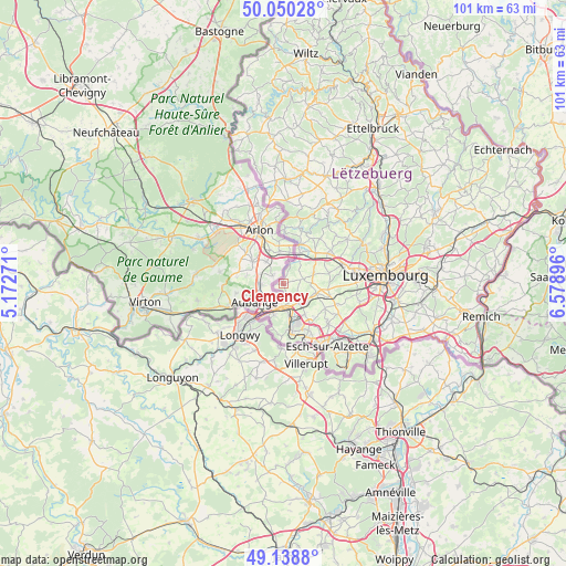
Clemency GPS coordinates[2]
49° 35' 48.012" North, 5° 52' 32.988" East
| Map corner | latitude | longitude |
|---|---|---|
| Upper-left | 50.05028°, | 5.17271° |
| Center: | 49.59667°, | 5.87583° |
| Lower-right: | 49.1388°, | 6.57896° |
| Map W x H: | 101.3×101.3 km | = 62.9×62.9mi |
| max Lat: | 50.13722° ⇑67.2% North |
| Clemency: | 49.59667° |
| min Lat: | ⇓32.8% South 49.45964° |
| min Long | Clemency | max Long |
| 5.76583° | 5.87583° | 6.50532° |
| W 4%⇐ | ⇒96% E |
Elevation
Elevation of Clemency is 334 m = 1096 ft, and this is 52 m = 171 ft above average elevation for this country.
| Max E: |
502 m = 1647 ft | 15.8% |
| Clemency | 334 m 1096 ft | |
| Avg. | 282 m = 925 ft | |
Min E: |
143 m = 469 ft | 84.2% |
See also: Luxembourg elevation on elevation.city.
Geographical zone
Clemency is located in North temperate zone (between Tropic of Cancer and the Arctic Circle). Distance of this North polar circle is 1886.5 km =1172.2 mi to North.| Distance of | km | miles | from Clemency |
|---|---|---|---|
| North Pole | 4492.4 | 2791.4 | to North |
| Arctic Circle | 1886.5 | 1172.2 | to North |
| Tropic Cancer | 2908.7 | 1807.4 | to South |
| Equator | 5514.6 | 3426.6 | to South |


Nearby cities:
15 places around Clemency: (largest is in red/bold)
• Bascharage
4 km =2.5 mi,  145°
145°
• Bettange-sur-Mess
8.1 km =5 mi,  106°
106°
• Dippach
7.8 km =4.8 mi,  97°
97°
• Garnich
6 km =3.7 mi,  68°
68°
• Hagen
7.1 km =4.4 mi,  34°
34°
• Hautcharage
3.4 km =2.1 mi,  134°
134°
• Kleinbettingen
6.3 km =3.9 mi, 27°
• Lamadelaine
5.8 km =3.6 mi,  194°
194°
• Linger
3.5 km =2.2 mi,  167°
167°
• Niedercorn
6.8 km =4.2 mi, 169°
• Pétange
4.3 km =2.7 mi,  175°
175°
• Rodange
6.1 km =3.8 mi,  204°
204°
• Sanem
6.6 km =4.1 mi,  144°
144°
• Schouweiler
6 km =3.7 mi, 105°
• Steinfort
7.8 km =4.8 mi,  23°
23°
Sources, notices
• [Note1] Compared only with cities in Luxembourg existing in our database
• [Src1] Map data: © OpenStreetMap contributors (CC-BY-SA)
• [Src2] Other city data from geonames.org with taken over terms of usage.
• [Src3] Geographical zone / Annual Mean Temperature by Robert A. Rohde @ Wikipedia
