Kelaat Mgouna geodata
Kelaat Mgouna (Drâa-Tafilalet) is a populated place; located in Morocco in Africa/Casablanca (GMT+1) time zone. With population of 14,190 people, there are 84 cities with bigger population in this country. Compared to other cities in Morocco, 77.9% of cities are located further ↑North; 53.1% of cities are located further →East and 91.9% of cities have lower elevation than Kelaat Mgouna. Note1
Administrative division(s):
- Level 1: Drâa-Tafilalet
- Level 2: Tinghir Province
- Level 3: Kalaat M'Gouna


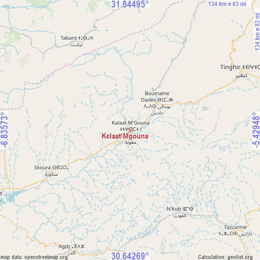
Kelaat Mgouna GPS coordinates[2]
31° 14' 44.628" North, 6° 7' 57.36" West
| Map corner | latitude | longitude |
|---|---|---|
| Upper-left | 31.84495°, | -6.83573° |
| Center: | 31.24573°, | -6.1326° |
| Lower-right: | 30.64269°, | -5.42948° |
| Map W x H: | 133.7×133.7 km | = 83.1×83.1mi |
| max Lat: | 35.84906° ⇑77.9% North |
| Kelaat Mgouna: | 31.24573° |
| min Lat: | ⇓22.1% South 22.6558° |
| min Long | Kelaat Mgouna | max Long |
| -15.60719° | -6.1326° | -1.22855° |
| W 46.9%⇐ | ⇒53.1% E |
Elevation
Elevation of Kelaat Mgouna is 1431 m = 4695 ft, and this is 814.2 m = 2671 ft above average elevation for this country.
| Max E: |
2637 m = 8652 ft | 8.1% |
| Kelaat Mgouna | 1431 m 4695 ft | |
| Avg. | 616.8 m = 2024 ft | |
Min E: |
1 m = 3 ft | 91.9% |
See also: Morocco elevation on elevation.city.
Geographical zone
Kelaat Mgouna is located in North temperate zone (between Tropic of Cancer and the Arctic Circle). Distance of this Northern Tropic circle is 868.3 km =539.5 mi to South.| Distance of | km | miles | from Kelaat Mgouna |
|---|---|---|---|
| North Pole | 6532.9 | 4059.4 | to North |
| Arctic Circle | 3927 | 2440.1 | to North |
| Tropic Cancer | 868.3 | 539.5 | to South |
| Equator | 3474.2 | 2158.8 | to South |


Nearby cities:
15 places around Kelaat Mgouna: (largest is in red/bold)
• Agdz
68.3 km =42.4 mi,  205°
205°
• Alnif
92.6 km =57.5 mi,  99°
99°
• Anergui
93.4 km =58 mi,  11°
11°
• Azilal
89.8 km =55.8 mi,  332°
332°
• Demnate
99 km =61.5 mi,  303°
303°
• Ifrane
54.8 km =34.1 mi,  337°
337°
• Imider
35.2 km =21.9 mi,  66°
66°
• Jebel Tiskaouine
99.7 km =62 mi, 104°
• Ouaoula
90.8 km =56.4 mi,  319°
319°
• Ouarzazat
81 km =50.3 mi,  243°
243°
• Skoura
44.8 km =27.8 mi, 242°
• Tabant
52.4 km =32.6 mi, 329°
• Tifni
87.7 km =54.5 mi, 298°
• Tilmi
72.4 km =45 mi,  28°
28°
• Tinghir
64.3 km =40 mi,  62°
62°
Sources, notices
• [Note1] Compared only with cities in Morocco existing in our database
• [Src1] Map data: © OpenStreetMap contributors (CC-BY-SA)
• [Src2] Other city data from geonames.org with taken over terms of usage.
• [Src3] Geographical zone / Annual Mean Temperature by Robert A. Rohde @ Wikipedia
