Anergui geodata
Anergui (Béni Mellal-Khénifra) is a seat of a third-order administrative division; located in Morocco in Africa/Casablanca (GMT+1) time zone. In our database, there are 108 cities with bigger population. Compared to other cities in Morocco, 65.1% of cities are located further ↑North; 50.8% of cities are located further ←West and 93% of cities have lower elevation than Anergui. Note1


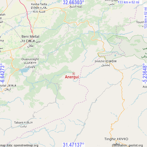
Anergui GPS coordinates[2]
32° 4' 8.904" North, 5° 56' 22.596" West
| Map corner | latitude | longitude |
|---|---|---|
| Upper-left | 32.66303°, | -6.64273° |
| Center: | 32.06914°, | -5.93961° |
| Lower-right: | 31.47137°, | -5.23648° |
| Map W x H: | 132.5×132.5 km | = 82.3×82.3mi |
| max Lat: | 35.84906° ⇑65.1% North |
| Anergui: | 32.06914° |
| min Lat: | ⇓34.9% South 22.6558° |
| min Long | Anergui | max Long |
| -15.60719° | -5.93961° | -1.22855° |
| W 50.8%⇐ | ⇒49.2% E |
Elevation
Elevation of Anergui is 1468 m = 4816 ft, and this is 851.2 m = 2793 ft above average elevation for this country.
| Max E: |
2637 m = 8652 ft | 7% |
| Anergui | 1468 m 4816 ft | |
| Avg. | 616.8 m = 2024 ft | |
Min E: |
1 m = 3 ft | 93% |
See also: Morocco elevation on elevation.city.
Geographical zone
Anergui is located in North temperate zone (between Tropic of Cancer and the Arctic Circle). Distance of this Northern Tropic circle is 959.8 km =596.4 mi to South.| Distance of | km | miles | from Anergui |
|---|---|---|---|
| North Pole | 6441.3 | 4002.4 | to North |
| Arctic Circle | 3835.4 | 2383.2 | to North |
| Tropic Cancer | 959.8 | 596.4 | to South |
| Equator | 3565.8 | 2215.7 | to South |


Nearby cities:
15 places around Anergui: (largest is in red/bold)
• Assoul
70.2 km =43.6 mi,  100°
100°
• Azilal
60.7 km =37.7 mi,  258°
258°
• Beni Mellal
48.8 km =30.3 mi,  307°
307°
• El Ksiba
56.5 km =35.1 mi,  352°
352°
• Ifrane
56.2 km =34.9 mi,  223°
223°
• Imilchil
31.1 km =19.3 mi,  72°
72°
• Isseksi
36.4 km =22.6 mi,  299°
299°
• Kasba Tadla
66.4 km =41.3 mi,  332°
332°
• Sidi Jaber
57.6 km =35.8 mi, 308°
• Tabant
64.2 km =39.9 mi, 223°
• Taounza
62.8 km =39 mi,  272°
272°
• Tilmi
32.3 km =20.1 mi,  149°
149°
• Timoulilt
51.8 km =32.2 mi,  286°
286°
• Tinghir
72.7 km =45.2 mi, 148°
• Zawyat ech Cheïkh
64 km =39.8 mi,  1°
1°
Sources, notices
• [Note1] Compared only with cities in Morocco existing in our database
• [Src1] Map data: © OpenStreetMap contributors (CC-BY-SA)
• [Src2] Other city data from geonames.org with taken over terms of usage.
• [Src3] Geographical zone / Annual Mean Temperature by Robert A. Rohde @ Wikipedia
