Ungheni geodata
Ungheni is a seat of a first-order administrative division; located in Moldova in Europe/Chisinau (GMT+3) time zone. With population of 34,422 people, there are 6 cities with bigger population in this country. Compared to other cities in Moldova, 54.8% of cities are located further ↓South; 87.7% of cities are located further →East and 58.9% of cities have higher elevation than Ungheni. Note1


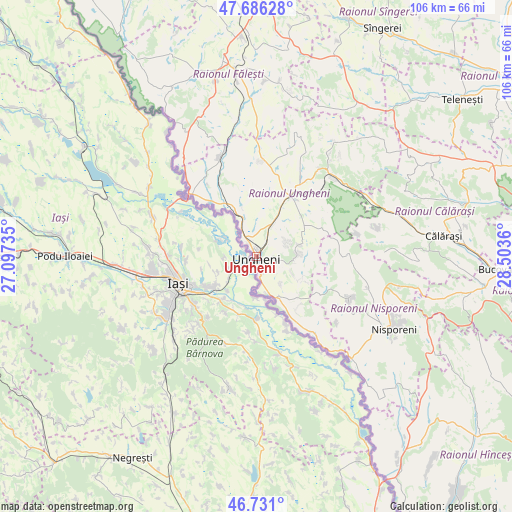
Ungheni GPS coordinates[2]
47° 12' 38.844" North, 27° 48' 1.692" East
| Map corner | latitude | longitude |
|---|---|---|
| Upper-left | 47.68628°, | 27.09735° |
| Center: | 47.21079°, | 27.80047° |
| Lower-right: | 46.731°, | 28.5036° |
| Map W x H: | 106.2×106.2 km | = 66×66mi |
| max Lat: | 48.43285° ⇑45.2% North |
| Ungheni: | 47.21079° |
| min Lat: | ⇓54.8% South 45.48167° |
| min Long | Ungheni | max Long |
| 27.07787° | 27.80047° | 29.9617° |
| W 12.3%⇐ | ⇒87.7% E |
Elevation
Elevation of Ungheni is 66 m = 217 ft, and this is 26.8 m = 88 ft below average elevation for this country.
| Max E: |
241 m = 791 ft | 58.9% |
| Avg. | 92.8 m = 304 ft | |
| Ungheni | 66 m = 217 ft | |
Min E: |
11 m = 36 ft | 41.1% |
See also: Moldova elevation on elevation.city.
Geographical zone
Ungheni is located in North temperate zone (between Tropic of Cancer and the Arctic Circle). Distance of this North polar circle is 2151.8 km =1337.1 mi to North.| Distance of | km | miles | from Ungheni |
|---|---|---|---|
| North Pole | 4757.7 | 2956.3 | to North |
| Arctic Circle | 2151.8 | 1337.1 | to North |
| Tropic Cancer | 2643.4 | 1642.5 | to South |
| Equator | 5249.3 | 3261.8 | to South |


Nearby cities:
15 places around Ungheni: (largest is in red/bold)
• Bilicenii Vechi
52.8 km =32.8 mi,  20°
20°
• Biruinţa
70 km =43.5 mi, 16°
• Bucovăţ
49.7 km =30.9 mi,  92°
92°
• Bălţi
62.2 km =38.6 mi,  8°
8°
• Călăraşi
38.8 km =24.1 mi,  82°
82°
• Dancu
59 km =36.7 mi,  148°
148°
• Fălești
41.2 km =25.6 mi,  350°
350°
• Glodeni
66.2 km =41.1 mi,  341°
341°
• Hînceşti
73.3 km =45.5 mi,  125°
125°
• Mîndreşti
48.6 km =30.2 mi,  47°
47°
• Nisporeni
31.5 km =19.6 mi,  117°
117°
• Strășeni
61.5 km =38.2 mi,  97°
97°
• Sîngerei
53.9 km =33.5 mi,  28°
28°
• Teleneşti
53.4 km =33.2 mi, 52°
• Vatra
72.4 km =45 mi, 102°
Sources, notices
• [Note1] Compared only with cities in Moldova existing in our database
• [Src1] Map data: © OpenStreetMap contributors (CC-BY-SA)
• [Src2] Other city data from geonames.org with taken over terms of usage.
• [Src3] Geographical zone / Annual Mean Temperature by Robert A. Rohde @ Wikipedia
