Žabljak geodata
Žabljak (Opština Žabljak) is a seat of a first-order administrative division; located in Montenegro in Europe/Podgorica (GMT+2) time zone. With population of 1,937 people, there are 23 cities with bigger population in this country. Compared to other cities in Montenegro, 96.8% of cities are located further ↓South; 50.8% of cities are located further ←West and 100% of cities have lower elevation than Žabljak. Note1


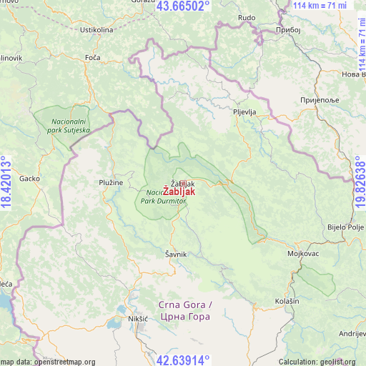
Žabljak GPS coordinates[2]
43° 9' 15.228" North, 19° 7' 23.7" East
| Map corner | latitude | longitude |
|---|---|---|
| Upper-left | 43.66502°, | 18.42013° |
| Center: | 43.15423°, | 19.12325° |
| Lower-right: | 42.63914°, | 19.82638° |
| Map W x H: | 114.1×114.1 km | = 70.9×70.9mi |
| max Lat: | 43.38472° ⇑3.2% North |
| Žabljak: | 43.15423° |
| min Lat: | ⇓96.8% South 41.92936° |
| min Long | Žabljak | max Long |
| 18.50647° | 19.12325° | 20.16652° |
| W 50.8%⇐ | ⇒49.2% E |
Elevation
Elevation of Žabljak is 1448 m = 4751 ft, and this is 1102 m = 3615 ft above average elevation for this country.
| Max E: |
1448 m = 4751 ft | 0% |
| Žabljak | 1448 m 4751 ft | |
| Avg. | 346 m = 1135 ft | |
Min E: |
4 m = 13 ft | 100% |
See also: Montenegro elevation on elevation.city.
Geographical zone
Žabljak is located in North temperate zone (between Tropic of Cancer and the Arctic Circle). Distance of this Northern Tropic circle is 2192.4 km =1362.3 mi to South.| Distance of | km | miles | from Žabljak |
|---|---|---|---|
| North Pole | 5208.8 | 3236.6 | to North |
| Arctic Circle | 2602.9 | 1617.4 | to North |
| Tropic Cancer | 2192.4 | 1362.3 | to South |
| Equator | 4798.3 | 2981.5 | to South |


Nearby cities:
15 places around Žabljak: (largest is in red/bold)
• Barice
30.3 km =18.8 mi,  104°
104°
• Bijelo Polje
52.3 km =32.5 mi, 104°
• Danilovgrad
66.8 km =41.5 mi,  178°
178°
• Dučice
48.8 km =30.3 mi, 179°
• Kolašin
48.8 km =30.3 mi,  139°
139°
• Kuta
45.9 km =28.5 mi, 180°
• Miločani
40.3 km =25 mi,  206°
206°
• Mojkovac
43.1 km =26.8 mi,  119°
119°
• Nikšić
44.8 km =27.8 mi,  198°
198°
• Pljevlja
29.5 km =18.3 mi,  40°
40°
• Plužine
23 km =14.3 mi,  269°
269°
• Zagrad
45 km =28 mi, 183°
• Ćurilac
68.9 km =42.8 mi, 180°
• Šavnik
22.1 km =13.7 mi,  185°
185°
• Šula
25.9 km =16.1 mi,  350°
350°
Sources, notices
• [Note1] Compared only with cities in Montenegro existing in our database
• [Src1] Map data: © OpenStreetMap contributors (CC-BY-SA)
• [Src2] Other city data from geonames.org with taken over terms of usage.
• [Src3] Geographical zone / Annual Mean Temperature by Robert A. Rohde @ Wikipedia
