Šula geodata
Šula (Pljevlja) is a populated locality; located in Montenegro in Europe/Podgorica (GMT+2) time zone. With population of 995 people, there are 35 cities with bigger population in this country. Compared to other cities in Montenegro, 100% of cities are located further ↓South; 60.3% of cities are located further →East and 96.8% of cities have lower elevation than Šula. Note1


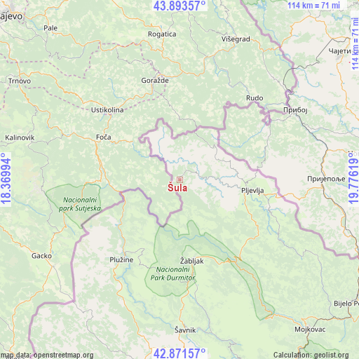
Šula GPS coordinates[2]
43° 23' 4.992" North, 19° 4' 23.016" East
| Map corner | latitude | longitude |
|---|---|---|
| Upper-left | 43.89357°, | 18.36994° |
| Center: | 43.38472°, | 19.07306° |
| Lower-right: | 42.87157°, | 19.77619° |
| Map W x H: | 113.6×113.6 km | = 70.6×70.6mi |
| max Lat: | 43.38472° ⇑0% North |
| Šula: | 43.38472° |
| min Lat: | ⇓100% South 41.92936° |
| min Long | Šula | max Long |
| 18.50647° | 19.07306° | 20.16652° |
| W 39.7%⇐ | ⇒60.3% E |
Elevation
Elevation of Šula is 1105 m = 3625 ft, and this is 759 m = 2490 ft above average elevation for this country.
| Max E: |
1448 m = 4751 ft | 3.2% |
| Šula | 1105 m 3625 ft | |
| Avg. | 346 m = 1135 ft | |
Min E: |
4 m = 13 ft | 96.8% |
See also: Montenegro elevation on elevation.city.
Geographical zone
Šula is located in North temperate zone (between Tropic of Cancer and the Arctic Circle). Distance of this Northern Tropic circle is 2218 km =1378.2 mi to South.| Distance of | km | miles | from Šula |
|---|---|---|---|
| North Pole | 5183.1 | 3220.6 | to North |
| Arctic Circle | 2577.2 | 1601.4 | to North |
| Tropic Cancer | 2218 | 1378.2 | to South |
| Equator | 4823.9 | 2997.4 | to South |


Nearby cities:
15 places around Šula: (largest is in red/bold)
• Barice
47 km =29.2 mi,  134°
134°
• Berane
88.6 km =55.1 mi, 132°
• Bijelo Polje
66.9 km =41.6 mi, 125°
• Dučice
74.5 km =46.3 mi,  176°
176°
• Kolašin
72.2 km =44.9 mi,  150°
150°
• Kuta
71.7 km =44.6 mi, 177°
• Miločani
63.3 km =39.3 mi,  192°
192°
• Mojkovac
62.7 km =39 mi,  138°
138°
• Nikšić
68.8 km =42.8 mi, 188°
• Petnjica
89.6 km =55.7 mi, 126°
• Pljevlja
23.3 km =14.5 mi,  97°
97°
• Plužine
32 km =19.9 mi,  216°
216°
• Zagrad
70.6 km =43.9 mi, 178°
• Šavnik
47.7 km =29.6 mi, 177°
• Žabljak
25.9 km =16.1 mi,  170°
170°
Sources, notices
• [Note1] Compared only with cities in Montenegro existing in our database
• [Src1] Map data: © OpenStreetMap contributors (CC-BY-SA)
• [Src2] Other city data from geonames.org with taken over terms of usage.
• [Src3] Geographical zone / Annual Mean Temperature by Robert A. Rohde @ Wikipedia
