Sahavato geodata
Sahavato (Vatovavy Fitovinany) is a populated place; located in Madagascar in Indian/Antananarivo (GMT+3) time zone. With population of 28,000 people, there are 38 cities with bigger population in this country. Compared to other cities in Madagascar, 67.5% of cities are located further ↑North; 72.4% of cities are located further ←West and 67.5% of cities have higher elevation than Sahavato. Note1
Administrative division(s):
- Level 1: Vatovavy Fitovinany
- Level 2: Nosy-Varika
- Level 3: Sahavato
- Level 4: Ampiranambo


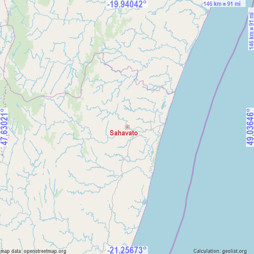
Sahavato GPS coordinates[2]
20° 36' 0" South, 48° 19' 59.988" East
| Map corner | latitude | longitude |
|---|---|---|
| Upper-left | -19.94042°, | 47.63021° |
| Center: | -20.6°, | 48.33333° |
| Lower-right: | -21.25673°, | 49.03646° |
| Map W x H: | 146.4×146.4 km | = 91×91mi |
| max Lat: | -12.31732° ⇑67.5% North |
| Sahavato: | -20.6° |
| min Lat: | ⇓32.5% South -25.3° |
| min Long | Sahavato | max Long |
| 43.65° | 48.33333° | 50.27876° |
| W 72.4%⇐ | ⇒27.6% E |
Elevation
Elevation of Sahavato is 54 m = 177 ft, and this is 503.4 m = 1652 ft below average elevation for this country.
| Max E: |
1763 m = 5784 ft | 67.5% |
| Avg. | 557.4 m = 1829 ft | |
| Sahavato | 54 m = 177 ft | |
Min E: |
1 m = 3 ft | 32.5% |
See also: Madagascar elevation on elevation.city.
Geographical zone
Sahavato is located in South Torrid zone (between Equator and Tropic of Capricorn). Distance of this Southern Tropic circle is 315.4 km =196 mi to South.| Distance of | km | miles | from Sahavato |
|---|---|---|---|
| Equator | 2290.5 | 1423.3 | to North |
| Tropic Capricorn | 315.4 | 196 | to South |
| Antarctic Circle | 5110.7 | 3175.6 | to South |
| South Pole | 7716.6 | 4794.9 | to South |


Nearby cities:
15 places around Sahavato: (largest is in red/bold)
• Ambatofinandrahana
159.3 km =99 mi,  271°
271°
• Ambositra
113.7 km =70.6 mi, 273°
• Antanifotsy
149.7 km =93 mi,  314°
314°
• Antsampanimahazo
162.8 km =101.2 mi, 310°
• Antsirabe
158.3 km =98.4 mi,  301°
301°
• Fandrandava
151.7 km =94.3 mi,  227°
227°
• Fandriana
107.1 km =66.5 mi,  292°
292°
• Fianarantsoa
160.5 km =99.7 mi, 233°
• Ifanadiana
106.5 km =66.2 mi,  223°
223°
• Mahanoro
91.8 km =57 mi,  32°
32°
• Mananjary
70.1 km =43.6 mi,  179°
179°
• Marolambo
65.2 km =40.5 mi,  339°
339°
• Nosy Varika
20.9 km =13 mi,  84°
84°
• Soanindrariny
138.7 km =86.2 mi, 304°
• Vohimanitra
138.8 km =86.2 mi,  208°
208°
Sources, notices
• [Note1] Compared only with cities in Madagascar existing in our database
• [Src1] Map data: © OpenStreetMap contributors (CC-BY-SA)
• [Src2] Other city data from geonames.org with taken over terms of usage.
• [Src3] Geographical zone / Annual Mean Temperature by Robert A. Rohde @ Wikipedia
