Mananjary geodata
Mananjary (Vatovavy Fitovinany) is a populated place; located in Madagascar in Indian/Antananarivo (GMT+3) time zone. With population of 27,686 people, there are 39 cities with bigger population in this country. Compared to other cities in Madagascar, 69.1% of cities are located further ↑North; 73.2% of cities are located further ←West and 96.7% of cities have higher elevation than Mananjary. Note1
Administrative division(s):
- Level 1: Vatovavy Fitovinany
- Level 2: Mananjary
- Level 3: Mananjary
- Level 4: Analananjavidy


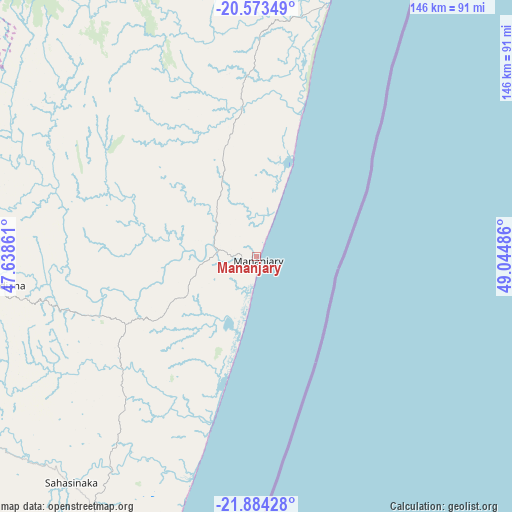
Mananjary GPS coordinates[2]
21° 13' 49.224" South, 48° 20' 30.228" East
| Map corner | latitude | longitude |
|---|---|---|
| Upper-left | -20.57349°, | 47.63861° |
| Center: | -21.23034°, | 48.34173° |
| Lower-right: | -21.88428°, | 49.04486° |
| Map W x H: | 145.7×145.7 km | = 90.5×90.5mi |
| max Lat: | -12.31732° ⇑69.1% North |
| Mananjary: | -21.23034° |
| min Lat: | ⇓30.9% South -25.3° |
| min Long | Mananjary | max Long |
| 43.65° | 48.34173° | 50.27876° |
| W 73.2%⇐ | ⇒26.8% E |
Elevation
Elevation of Mananjary is 7 m = 23 ft, and this is 550.4 m = 1806 ft below average elevation for this country.
| Max E: |
1763 m = 5784 ft | 96.7% |
| Avg. | 557.4 m = 1829 ft | |
| Mananjary | 7 m = 23 ft | |
Min E: |
1 m = 3 ft | 3.3% |
See also: Madagascar elevation on elevation.city.
Geographical zone
Mananjary is located in South Torrid zone (between Equator and Tropic of Capricorn). Distance of this Southern Tropic circle is 245.3 km =152.4 mi to South.| Distance of | km | miles | from Mananjary |
|---|---|---|---|
| Equator | 2360.6 | 1466.8 | to North |
| Tropic Capricorn | 245.3 | 152.4 | to South |
| Antarctic Circle | 5040.6 | 3132.1 | to South |
| South Pole | 7646.5 | 4751.3 | to South |


Nearby cities:
15 places around Mananjary: (largest is in red/bold)
• Amboanjo
99.5 km =61.8 mi,  210°
210°
• Ambositra
138.1 km =85.8 mi,  304°
304°
• Fandrandava
117.4 km =72.9 mi,  254°
254°
• Fandriana
149.1 km =92.6 mi,  318°
318°
• Fianarantsoa
132.4 km =82.3 mi,  259°
259°
• Ifanadiana
73.8 km =45.9 mi, 263°
• Ifatsy
143.7 km =89.3 mi, 205°
• Ikongo
118.7 km =73.8 mi,  232°
232°
• Mahanoro
155.4 km =96.6 mi,  17°
17°
• Manakara
107.7 km =66.9 mi,  198°
198°
• Marolambo
133.3 km =82.8 mi,  349°
349°
• Nosy Varika
74.6 km =46.4 mi, 15°
• Sahavato
70.1 km =43.6 mi,  359°
359°
• Savana
136.1 km =84.6 mi, 199°
• Vohimanitra
84.5 km =52.5 mi, 231°
Sources, notices
• [Note1] Compared only with cities in Madagascar existing in our database
• [Src1] Map data: © OpenStreetMap contributors (CC-BY-SA)
• [Src2] Other city data from geonames.org with taken over terms of usage.
• [Src3] Geographical zone / Annual Mean Temperature by Robert A. Rohde @ Wikipedia
