Dzuunmod geodata
Dzuunmod (Central Aimak) is a seat of a first-order administrative division; located in Mongolia in Asia/Ulaanbaatar (GMT+8) time zone. With population of 14,660 people, there are 22 cities with bigger population in this country. Compared to other cities in Mongolia, 51.2% of cities are located further ↓South; 77.3% of cities are located further ←West and 63.8% of cities have lower elevation than Dzuunmod. Note1


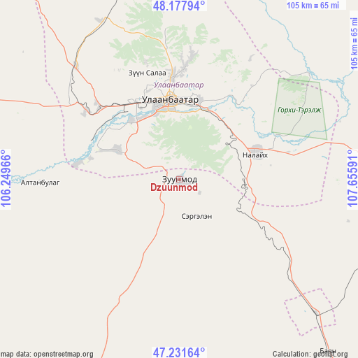
Dzuunmod GPS coordinates[2]
47° 42' 24.984" North, 106° 57' 10.008" East
| Map corner | latitude | longitude |
|---|---|---|
| Upper-left | 48.17794°, | 106.24966° |
| Center: | 47.70694°, | 106.95278° |
| Lower-right: | 47.23164°, | 107.65591° |
| Map W x H: | 105.2×105.2 km | = 65.4×65.4mi |
| max Lat: | 51.50725° ⇑48.8% North |
| Dzuunmod: | 47.70694° |
| min Lat: | ⇓51.2% South 42.84199° |
| min Long | Dzuunmod | max Long |
| 89.14358° | 106.95278° | 118.51014° |
| W 77.3%⇐ | ⇒22.7% E |
Elevation
Elevation of Dzuunmod is 1514 m = 4967 ft, and this is 97.5 m = 320 ft above average elevation for this country.
| Max E: |
2800 m = 9186 ft | 36.2% |
| Dzuunmod | 1514 m 4967 ft | |
| Avg. | 1416.5 m = 4647 ft | |
Min E: |
619 m = 2031 ft | 63.8% |
See also: Mongolia elevation on elevation.city.
Geographical zone
Dzuunmod is located in North temperate zone (between Tropic of Cancer and the Arctic Circle). Distance of this North polar circle is 2096.7 km =1302.8 mi to North.| Distance of | km | miles | from Dzuunmod |
|---|---|---|---|
| North Pole | 4702.5 | 2922 | to North |
| Arctic Circle | 2096.7 | 1302.8 | to North |
| Tropic Cancer | 2698.6 | 1676.8 | to South |
| Equator | 5304.5 | 3296.1 | to South |


Nearby cities:
15 places around Dzuunmod: (largest is in red/bold)
• Altanbulag
41.4 km =25.7 mi,  268°
268°
• Argalant
83.1 km =51.6 mi,  288°
288°
• Arhust
70.2 km =43.6 mi,  82°
82°
• Bayanbaraat
107.4 km =66.7 mi,  209°
209°
• Bayandelger
86.6 km =53.8 mi,  88°
88°
• Bornuur
98.7 km =61.3 mi,  328°
328°
• Dund-Urt
85.2 km =52.9 mi,  295°
295°
• Dzogsool
101.9 km =63.3 mi,  171°
171°
• Dzüünkharaa
104.3 km =64.8 mi,  351°
351°
• Höshigiyn-Ar
16.7 km =10.4 mi,  177°
177°
• Ihsüüj
75.8 km =47.1 mi,  319°
319°
• Maanĭt
67 km =41.6 mi,  139°
139°
• Mandal
75.5 km =46.9 mi, 347°
• Ulan Bator
22.9 km =14.2 mi, 346°
• Зуунмод
0 km =0 mi,  233°
233°
Sources, notices
• [Note1] Compared only with cities in Mongolia existing in our database
• [Src1] Map data: © OpenStreetMap contributors (CC-BY-SA)
• [Src2] Other city data from geonames.org with taken over terms of usage.
• [Src3] Geographical zone / Annual Mean Temperature by Robert A. Rohde @ Wikipedia
