Bayandelger geodata
Bayandelger (Central Aimak) is a seat of a second-order administrative division; located in Mongolia in Asia/Ulaanbaatar (GMT+8) time zone. In our database, there are 33 cities with bigger population. Compared to other cities in Mongolia, 51.5% of cities are located further ↓South; 80.7% of cities are located further ←West and 56.7% of cities have lower elevation than Bayandelger. Note1


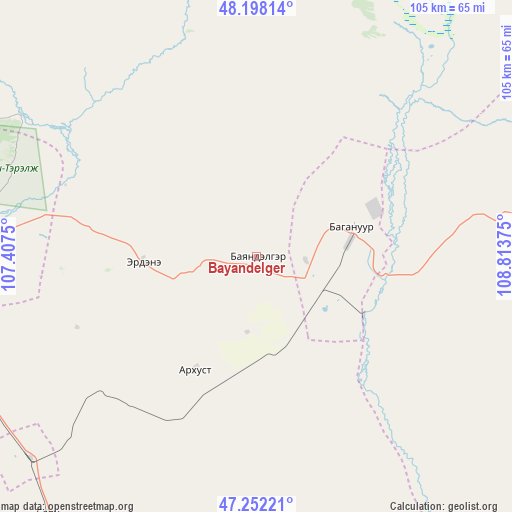
Bayandelger GPS coordinates[2]
47° 43' 38.352" North, 108° 6' 38.232" East
| Map corner | latitude | longitude |
|---|---|---|
| Upper-left | 48.19814°, | 107.4075° |
| Center: | 47.72732°, | 108.11062° |
| Lower-right: | 47.25221°, | 108.81375° |
| Map W x H: | 105.2×105.2 km | = 65.4×65.4mi |
| max Lat: | 51.50725° ⇑48.5% North |
| Bayandelger: | 47.72732° |
| min Lat: | ⇓51.5% South 42.84199° |
| min Long | Bayandelger | max Long |
| 89.14358° | 108.11062° | 118.51014° |
| W 80.7%⇐ | ⇒19.3% E |
Elevation
Elevation of Bayandelger is 1450 m = 4757 ft, and this is 33.5 m = 110 ft above average elevation for this country.
| Max E: |
2800 m = 9186 ft | 43.3% |
| Bayandelger | 1450 m 4757 ft | |
| Avg. | 1416.5 m = 4647 ft | |
Min E: |
619 m = 2031 ft | 56.7% |
See also: Mongolia elevation on elevation.city.
Geographical zone
Bayandelger is located in North temperate zone (between Tropic of Cancer and the Arctic Circle). Distance of this North polar circle is 2094.4 km =1301.4 mi to North.| Distance of | km | miles | from Bayandelger |
|---|---|---|---|
| North Pole | 4700.3 | 2920.6 | to North |
| Arctic Circle | 2094.4 | 1301.4 | to North |
| Tropic Cancer | 2700.9 | 1678.3 | to South |
| Equator | 5306.8 | 3297.5 | to South |


Nearby cities:
15 places around Bayandelger: (largest is in red/bold)
• Altanbulag
128 km =79.5 mi,  268°
268°
• Arhust
18.5 km =11.5 mi,  293°
293°
• Avraga
101.5 km =63.1 mi,  126°
126°
• Bayanbulag
135.8 km =84.4 mi,  83°
83°
• Bayantal
130.4 km =81 mi,  173°
173°
• Bayasgalant
61.9 km =38.5 mi, 169°
• Bulag
59.4 km =36.9 mi,  27°
27°
• Dzogsool
126 km =78.3 mi,  215°
215°
• Dzuunmod
86.6 km =53.8 mi, 268°
• Höshigiyn-Ar
88 km =54.7 mi,  257°
257°
• Maanĭt
68.5 km =42.6 mi, 219°
• Mandal
124.4 km =77.3 mi,  305°
305°
• Modot
70.3 km =43.7 mi,  87°
87°
• Ulan Bator
93.8 km =58.3 mi,  282°
282°
• Зуунмод
86.6 km =53.8 mi, 268°
Sources, notices
• [Note1] Compared only with cities in Mongolia existing in our database
• [Src1] Map data: © OpenStreetMap contributors (CC-BY-SA)
• [Src2] Other city data from geonames.org with taken over terms of usage.
• [Src3] Geographical zone / Annual Mean Temperature by Robert A. Rohde @ Wikipedia
