Dzadgay geodata
Dzadgay (Bayanhongor) is a seat of a second-order administrative division; located in Mongolia in Asia/Ulaanbaatar (GMT+8) time zone. In our database, there are 33 cities with bigger population. Compared to other cities in Mongolia, 75.8% of cities are located further ↑North; 67.5% of cities are located further →East and 89.6% of cities have lower elevation than Dzadgay. Note1


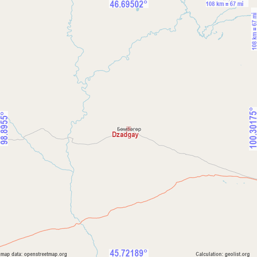
Dzadgay GPS coordinates[2]
46° 12' 38.196" North, 99° 35' 55.032" East
| Map corner | latitude | longitude |
|---|---|---|
| Upper-left | 46.69502°, | 98.8955° |
| Center: | 46.21061°, | 99.59862° |
| Lower-right: | 45.72189°, | 100.30175° |
| Map W x H: | 108.2×108.2 km | = 67.2×67.2mi |
| max Lat: | 51.50725° ⇑75.8% North |
| Dzadgay: | 46.21061° |
| min Lat: | ⇓24.2% South 42.84199° |
| min Long | Dzadgay | max Long |
| 89.14358° | 99.59862° | 118.51014° |
| W 32.5%⇐ | ⇒67.5% E |
Elevation
Elevation of Dzadgay is 2000 m = 6562 ft, and this is 583.5 m = 1914 ft above average elevation for this country.
| Max E: |
2800 m = 9186 ft | 10.4% |
| Dzadgay | 2000 m 6562 ft | |
| Avg. | 1416.5 m = 4647 ft | |
Min E: |
619 m = 2031 ft | 89.6% |
See also: Mongolia elevation on elevation.city.
Geographical zone
Dzadgay is located in North temperate zone (between Tropic of Cancer and the Arctic Circle). Distance of this North polar circle is 2263 km =1406.2 mi to North.| Distance of | km | miles | from Dzadgay |
|---|---|---|---|
| North Pole | 4868.9 | 3025.4 | to North |
| Arctic Circle | 2263 | 1406.2 | to North |
| Tropic Cancer | 2532.2 | 1573.4 | to South |
| Equator | 5138.1 | 3192.7 | to South |


Nearby cities:
15 places around Dzadgay: (largest is in red/bold)
• Bayanbulag
133.3 km =82.8 mi,  299°
299°
• Bayanhongor
68.9 km =42.8 mi,  35°
35°
• Bayanhongor
86.2 km =53.6 mi,  91°
91°
• Bayanhoshuu
68.7 km =42.7 mi, 37°
• Bayansayr
74 km =46 mi,  189°
189°
• Bodĭ
116.6 km =72.5 mi,  139°
139°
• Buyant
70 km =43.5 mi,  265°
265°
• Delgermörön
103.1 km =64.1 mi,  282°
282°
• Dzag
87.8 km =54.6 mi,  337°
337°
• Erdenetsogt
96.8 km =60.1 mi,  76°
76°
• Horiult
144.4 km =89.7 mi, 141°
• Höhbürd
65.9 km =40.9 mi, 82°
• Höviyn Am
137.9 km =85.7 mi,  325°
325°
• Jargalant
104.5 km =64.9 mi,  1°
1°
• Ulaan-Uul
95.2 km =59.2 mi,  99°
99°
Sources, notices
• [Note1] Compared only with cities in Mongolia existing in our database
• [Src1] Map data: © OpenStreetMap contributors (CC-BY-SA)
• [Src2] Other city data from geonames.org with taken over terms of usage.
• [Src3] Geographical zone / Annual Mean Temperature by Robert A. Rohde @ Wikipedia
