Bayansayr geodata
Bayansayr (Bayanhongor) is a seat of a second-order administrative division; located in Mongolia in Asia/Ulaanbaatar (GMT+8) time zone. In our database, there are 33 cities with bigger population. Compared to other cities in Mongolia, 85.3% of cities are located further ↑North; 68.7% of cities are located further →East and 53.4% of cities have higher elevation than Bayansayr. Note1


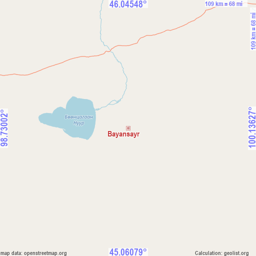
Bayansayr GPS coordinates[2]
45° 33' 19.044" North, 99° 25' 59.304" East
| Map corner | latitude | longitude |
|---|---|---|
| Upper-left | 46.04548°, | 98.73002° |
| Center: | 45.55529°, | 99.43314° |
| Lower-right: | 45.06079°, | 100.13627° |
| Map W x H: | 109.5×109.5 km | = 68×68mi |
| max Lat: | 51.50725° ⇑85.3% North |
| Bayansayr: | 45.55529° |
| min Lat: | ⇓14.7% South 42.84199° |
| min Long | Bayansayr | max Long |
| 89.14358° | 99.43314° | 118.51014° |
| W 31.3%⇐ | ⇒68.7% E |
Elevation
Elevation of Bayansayr is 1326 m = 4350 ft, and this is 90.5 m = 297 ft below average elevation for this country.
| Max E: |
2800 m = 9186 ft | 53.4% |
| Avg. | 1416.5 m = 4647 ft | |
| Bayansayr | 1326 m = 4350 ft | |
Min E: |
619 m = 2031 ft | 46.6% |
See also: Mongolia elevation on elevation.city.
Geographical zone
Bayansayr is located in North temperate zone (between Tropic of Cancer and the Arctic Circle). Distance of this North polar circle is 2335.9 km =1451.5 mi to North.| Distance of | km | miles | from Bayansayr |
|---|---|---|---|
| North Pole | 4941.8 | 3070.7 | to North |
| Arctic Circle | 2335.9 | 1451.5 | to North |
| Tropic Cancer | 2459.4 | 1528.2 | to South |
| Equator | 5065.3 | 3147.4 | to South |


Nearby cities:
15 places around Bayansayr: (largest is in red/bold)
• Bayanhongor
122.2 km =75.9 mi,  54°
54°
• Bayanhongor
139.5 km =86.7 mi,  22°
22°
• Bayanhoshuu
138.7 km =86.2 mi, 23°
• Bodĭ
90.4 km =56.2 mi,  100°
100°
• Bulgan
105.5 km =65.6 mi,  215°
215°
• Buyant
89 km =55.3 mi,  319°
319°
• Delgermörön
129.8 km =80.7 mi, 317°
• Dzadgay
74 km =46 mi,  9°
9°
• Dzalaa
114.4 km =71.1 mi,  186°
186°
• Horiult
111.4 km =69.2 mi,  110°
110°
• Höhbürd
113 km =70.2 mi,  44°
44°
• Sangiyn Dalay
139.6 km =86.7 mi,  250°
250°
• Talshand
115.8 km =72 mi,  257°
257°
• Ulaan-Uul
121.4 km =75.4 mi,  62°
62°
• Örgön
118.1 km =73.4 mi,  140°
140°
Sources, notices
• [Note1] Compared only with cities in Mongolia existing in our database
• [Src1] Map data: © OpenStreetMap contributors (CC-BY-SA)
• [Src2] Other city data from geonames.org with taken over terms of usage.
• [Src3] Geographical zone / Annual Mean Temperature by Robert A. Rohde @ Wikipedia
