Bayanhoshuu geodata
Bayanhoshuu (Bayanhongor) is a seat of a second-order administrative division; located in Mongolia in Asia/Ulaanbaatar (GMT+8) time zone. In our database, there are 33 cities with bigger population. Compared to other cities in Mongolia, 67.2% of cities are located further ↑North; 65% of cities are located further →East and 93.6% of cities have lower elevation than Bayanhoshuu. Note1


Bayanhoshuu GPS coordinates[2]
46° 42' 7.092" North, 100° 8' 35.88" East
| Map corner | latitude | longitude |
|---|---|---|
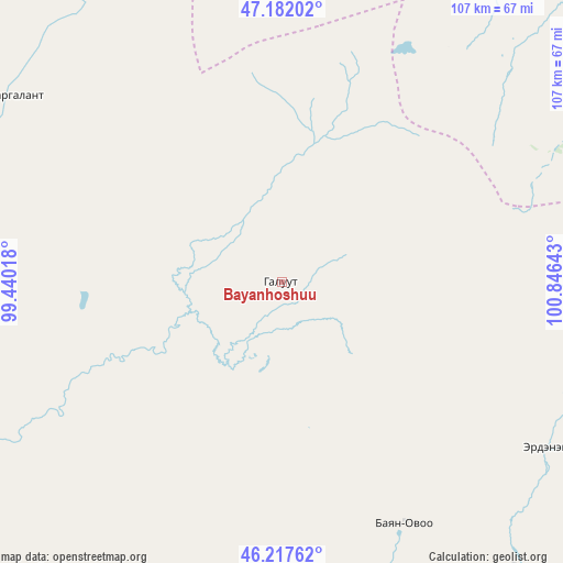
| Upper-left | 47.18202°, | 99.44018° |
| Center: | 46.70197°, | 100.1433° |
| Lower-right: | 46.21762°, | 100.84643° |
| Map W x H: | 107.2×107.2 km | = 66.6×66.6mi |
| max Lat: | 51.50725° ⇑67.2% North |
| Bayanhoshuu: | 46.70197° |
| min Lat: | ⇓32.8% South 42.84199° |
| min Long | Bayanhoshuu | max Long |
| 89.14358° | 100.1433° | 118.51014° |
| W 35%⇐ | ⇒65% E |
Elevation
Elevation of Bayanhoshuu is 2125 m = 6972 ft, and this is 708.5 m = 2324 ft above average elevation for this country.
| Max E: |
2800 m = 9186 ft | 6.4% |
| Bayanhoshuu | 2125 m 6972 ft | |
| Avg. | 1416.5 m = 4647 ft | |
Min E: |
619 m = 2031 ft | 93.6% |
See also: Mongolia elevation on elevation.city.
Geographical zone
Bayanhoshuu is located in North temperate zone (between Tropic of Cancer and the Arctic Circle). Distance of this North polar circle is 2208.4 km =1372.2 mi to North.| Distance of | km | miles | from Bayanhoshuu |
|---|---|---|---|
| North Pole | 4814.3 | 2991.5 | to North |
| Arctic Circle | 2208.4 | 1372.2 | to North |
| Tropic Cancer | 2586.9 | 1607.4 | to South |
| Equator | 5192.8 | 3226.7 | to South |


Nearby cities:
15 places around Bayanhoshuu: (largest is in red/bold)
• Bayanhongor
2.6 km =1.6 mi,  308°
308°
• Bayanhongor
71.6 km =44.5 mi,  142°
142°
• Bulagiyn Denj
100.7 km =62.6 mi,  47°
47°
• Buyant
126.2 km =78.4 mi,  241°
241°
• Dzaanhoshuu
104.1 km =64.7 mi,  32°
32°
• Dzadgay
68.7 km =42.7 mi,  217°
217°
• Dzag
78.9 km =49 mi,  289°
289°
• Erdenetsogt
60.7 km =37.7 mi,  121°
121°
• Höhbürd
51.8 km =32.2 mi,  153°
153°
• Höviyn Am
133 km =82.6 mi,  296°
296°
• Jargalant
63.1 km =39.2 mi,  322°
322°
• Jargalant
92.6 km =57.5 mi,  3°
3°
• Tsagaan-Ovoo
130.2 km =80.9 mi,  129°
129°
• Tsetserleg
131.3 km =81.6 mi, 49°
• Ulaan-Uul
87.5 km =54.4 mi, 143°
Sources, notices
• [Note1] Compared only with cities in Mongolia existing in our database
• [Src1] Map data: © OpenStreetMap contributors (CC-BY-SA)
• [Src2] Other city data from geonames.org with taken over terms of usage.
• [Src3] Geographical zone / Annual Mean Temperature by Robert A. Rohde @ Wikipedia
