Dzag geodata
Dzag (Bayanhongor) is a seat of a second-order administrative division; located in Mongolia in Asia/Ulaanbaatar (GMT+8) time zone. In our database, there are 33 cities with bigger population. Compared to other cities in Mongolia, 62.3% of cities are located further ↑North; 70.2% of cities are located further →East and 90.2% of cities have lower elevation than Dzag. Note1


Dzag GPS coordinates[2]
46° 56' 32.244" North, 99° 10' 0.804" East
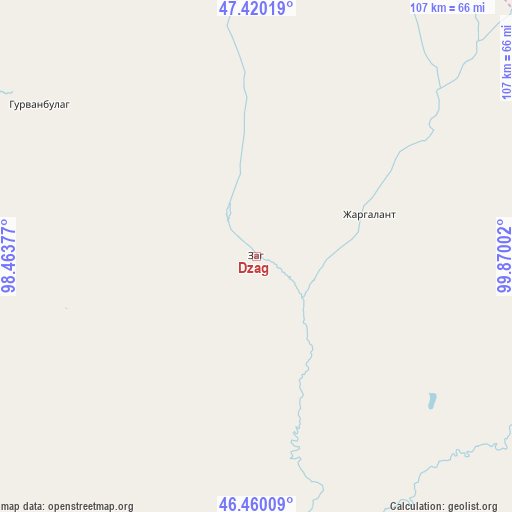
| Map corner | latitude | longitude |
|---|---|---|
| Upper-left | 47.42019°, | 98.46377° |
| Center: | 46.94229°, | 99.16689° |
| Lower-right: | 46.46009°, | 99.87002° |
| Map W x H: | 106.8×106.8 km | = 66.4×66.4mi |
| max Lat: | 51.50725° ⇑62.3% North |
| Dzag: | 46.94229° |
| min Lat: | ⇓37.7% South 42.84199° |
| min Long | Dzag | max Long |
| 89.14358° | 99.16689° | 118.51014° |
| W 29.8%⇐ | ⇒70.2% E |
Elevation
Elevation of Dzag is 2013 m = 6604 ft, and this is 596.5 m = 1957 ft above average elevation for this country.
| Max E: |
2800 m = 9186 ft | 9.8% |
| Dzag | 2013 m 6604 ft | |
| Avg. | 1416.5 m = 4647 ft | |
Min E: |
619 m = 2031 ft | 90.2% |
See also: Mongolia elevation on elevation.city.
Geographical zone
Dzag is located in North temperate zone (between Tropic of Cancer and the Arctic Circle). Distance of this North polar circle is 2181.7 km =1355.6 mi to North.| Distance of | km | miles | from Dzag |
|---|---|---|---|
| North Pole | 4787.6 | 2974.9 | to North |
| Arctic Circle | 2181.7 | 1355.6 | to North |
| Tropic Cancer | 2613.6 | 1624 | to South |
| Equator | 5219.5 | 3243.2 | to South |


Nearby cities:
15 places around Dzag: (largest is in red/bold)
• Bayanbulag
83.2 km =51.7 mi,  259°
259°
• Bayanhongor
76.5 km =47.5 mi,  109°
109°
• Bayanhoshuu
78.9 km =49 mi, 109°
• Buyant
93.6 km =58.2 mi,  202°
202°
• Buyant
121.9 km =75.7 mi,  284°
284°
• Delgermörön
89.5 km =55.6 mi,  228°
228°
• Dzaanhoshuu
143 km =88.9 mi,  64°
64°
• Dzadgay
87.8 km =54.6 mi,  157°
157°
• Erdenetsogt
139.1 km =86.4 mi, 114°
• Hunt
105.2 km =65.4 mi,  12°
12°
• Höhbürd
122.1 km =75.9 mi,  126°
126°
• Höviyn Am
55.4 km =34.4 mi,  305°
305°
• Jargalant
42.2 km =26.2 mi, 56°
• Jargalant
103 km =64 mi,  50°
50°
• Tsahir
128.7 km =80 mi,  349°
349°
Sources, notices
• [Note1] Compared only with cities in Mongolia existing in our database
• [Src1] Map data: © OpenStreetMap contributors (CC-BY-SA)
• [Src2] Other city data from geonames.org with taken over terms of usage.
• [Src3] Geographical zone / Annual Mean Temperature by Robert A. Rohde @ Wikipedia
