Höviyn Am geodata
Höviyn Am (Bayanhongor) is a seat of a second-order administrative division; located in Mongolia in Asia/Ulaanbaatar (GMT+8) time zone. In our database, there are 33 cities with bigger population. Compared to other cities in Mongolia, 57.7% of cities are located further ↑North; 72.4% of cities are located further →East and 98.8% of cities have lower elevation than Höviyn Am. Note1


Höviyn Am GPS coordinates[2]
47° 13' 52.428" North, 98° 34' 17.04" East
| Map corner | latitude | longitude |
|---|---|---|
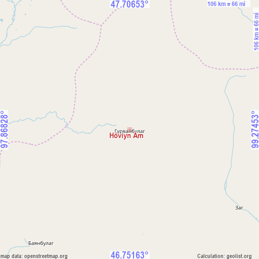
| Upper-left | 47.70653°, | 97.86828° |
| Center: | 47.23123°, | 98.5714° |
| Lower-right: | 46.75163°, | 99.27453° |
| Map W x H: | 106.2×106.2 km | = 66×66mi |
| max Lat: | 51.50725° ⇑57.7% North |
| Höviyn Am: | 47.23123° |
| min Lat: | ⇓42.3% South 42.84199° |
| min Long | Höviyn Am | max Long |
| 89.14358° | 98.5714° | 118.51014° |
| W 27.6%⇐ | ⇒72.4% E |
Elevation
Elevation of Höviyn Am is 2409 m = 7904 ft, and this is 992.5 m = 3256 ft above average elevation for this country.
| Max E: |
2800 m = 9186 ft | 1.2% |
| Höviyn Am | 2409 m 7904 ft | |
| Avg. | 1416.5 m = 4647 ft | |
Min E: |
619 m = 2031 ft | 98.8% |
See also: Mongolia elevation on elevation.city.
Geographical zone
Höviyn Am is located in North temperate zone (between Tropic of Cancer and the Arctic Circle). Distance of this North polar circle is 2149.6 km =1335.7 mi to North.| Distance of | km | miles | from Höviyn Am |
|---|---|---|---|
| North Pole | 4755.4 | 2954.9 | to North |
| Arctic Circle | 2149.6 | 1335.7 | to North |
| Tropic Cancer | 2645.7 | 1644 | to South |
| Equator | 5251.6 | 3263.2 | to South |


Nearby cities:
15 places around Höviyn Am: (largest is in red/bold)
• Balgatay
113.8 km =70.7 mi,  251°
251°
• Bayanbulag
59.4 km =36.9 mi,  217°
217°
• Bayanhongor
130.4 km =81 mi,  116°
116°
• Bayanhoshuu
133 km =82.6 mi, 116°
• Buyant
72.9 km =45.3 mi,  268°
268°
• Buyant
118.8 km =73.8 mi,  175°
175°
• Delgermörön
93.9 km =58.3 mi,  193°
193°
• Dzadgay
137.9 km =85.7 mi,  145°
145°
• Dzag
55.4 km =34.4 mi,  125°
125°
• Hunt
97.5 km =60.6 mi,  43°
43°
• Jargalant
80.7 km =50.1 mi,  96°
96°
• Jargalant
128.3 km =79.7 mi,  74°
74°
• Shiree
136.4 km =84.8 mi,  282°
282°
• Taygan
133.9 km =83.2 mi, 223°
• Tsahir
96.7 km =60.1 mi,  12°
12°
Sources, notices
• [Note1] Compared only with cities in Mongolia existing in our database
• [Src1] Map data: © OpenStreetMap contributors (CC-BY-SA)
• [Src2] Other city data from geonames.org with taken over terms of usage.
• [Src3] Geographical zone / Annual Mean Temperature by Robert A. Rohde @ Wikipedia
