Baruunturuun geodata
Baruunturuun (Uvs) is a seat of a second-order administrative division; located in Mongolia in Asia/Hovd (GMT+7) time zone. In our database, there are 33 cities with bigger population. Compared to other cities in Mongolia, 90.2% of cities are located further ↓South; 85.3% of cities are located further →East and 65.3% of cities have higher elevation than Baruunturuun. Note1


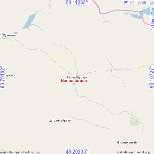
Baruunturuun GPS coordinates[2]
49° 39' 34.668" North, 94° 24' 14.904" East
| Map corner | latitude | longitude |
|---|---|---|
| Upper-left | 50.11265°, | 93.70102° |
| Center: | 49.65963°, | 94.40414° |
| Lower-right: | 49.20235°, | 95.10727° |
| Map W x H: | 101.2×101.2 km | = 62.9×62.9mi |
| max Lat: | 51.50725° ⇑9.8% North |
| Baruunturuun: | 49.65963° |
| min Lat: | ⇓90.2% South 42.84199° |
| min Long | Baruunturuun | max Long |
| 89.14358° | 94.40414° | 118.51014° |
| W 14.7%⇐ | ⇒85.3% E |
Elevation
Elevation of Baruunturuun is 1234 m = 4049 ft, and this is 182.5 m = 599 ft below average elevation for this country.
| Max E: |
2800 m = 9186 ft | 65.3% |
| Avg. | 1416.5 m = 4647 ft | |
| Baruunturuun | 1234 m = 4049 ft | |
Min E: |
619 m = 2031 ft | 34.7% |
See also: Mongolia elevation on elevation.city.
Geographical zone
Baruunturuun is located in North temperate zone (between Tropic of Cancer and the Arctic Circle). Distance of this North polar circle is 1879.5 km =1167.9 mi to North.| Distance of | km | miles | from Baruunturuun |
|---|---|---|---|
| North Pole | 4485.4 | 2787.1 | to North |
| Arctic Circle | 1879.5 | 1167.9 | to North |
| Tropic Cancer | 2915.7 | 1811.7 | to South |
| Equator | 5521.6 | 3431 | to South |


Nearby cities:
15 places around Baruunturuun: (largest is in red/bold)
• Altanbulag
145.4 km =90.3 mi,  105°
105°
• Altay
140.7 km =87.4 mi,  88°
88°
• Bugat
44.6 km =27.7 mi,  251°
251°
• Dzel
52.2 km =32.4 mi,  301°
301°
• Dzür
100 km =62.1 mi, 90°
• Holboo
140.6 km =87.4 mi,  147°
147°
• Hungiy
127.3 km =79.1 mi,  183°
183°
• Jargalant
85 km =52.8 mi,  117°
117°
• Naranbulag
136.6 km =84.9 mi,  256°
256°
• Sharbulag
133.2 km =82.8 mi,  225°
225°
• Tegsh
153.7 km =95.5 mi,  131°
131°
• Tooromt
107.2 km =66.6 mi,  326°
326°
• Tsagaanhayrhan
31.4 km =19.5 mi,  203°
203°
• Tsalgar
82.1 km =51 mi,  274°
274°
• Tsetserleg
54.2 km =33.7 mi,  142°
142°
Sources, notices
• [Note1] Compared only with cities in Mongolia existing in our database
• [Src1] Map data: © OpenStreetMap contributors (CC-BY-SA)
• [Src2] Other city data from geonames.org with taken over terms of usage.
• [Src3] Geographical zone / Annual Mean Temperature by Robert A. Rohde @ Wikipedia
