Jargalant geodata
Jargalant (Uvs) is a seat of a second-order administrative division; located in Mongolia in Asia/Hovd (GMT+7) time zone. In our database, there are 33 cities with bigger population. Compared to other cities in Mongolia, 83.7% of cities are located further ↓South; 82.2% of cities are located further →East and 79.4% of cities have lower elevation than Jargalant. Note1


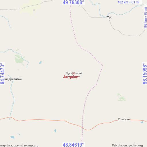
Jargalant GPS coordinates[2]
49° 18' 24.372" North, 95° 26' 52.26" East
| Map corner | latitude | longitude |
|---|---|---|
| Upper-left | 49.76308°, | 94.74473° |
| Center: | 49.30677°, | 95.44785° |
| Lower-right: | 48.84619°, | 96.15098° |
| Map W x H: | 101.9×101.9 km | = 63.3×63.3mi |
| max Lat: | 51.50725° ⇑16.3% North |
| Jargalant: | 49.30677° |
| min Lat: | ⇓83.7% South 42.84199° |
| min Long | Jargalant | max Long |
| 89.14358° | 95.44785° | 118.51014° |
| W 17.8%⇐ | ⇒82.2% E |
Elevation
Elevation of Jargalant is 1785 m = 5856 ft, and this is 368.5 m = 1209 ft above average elevation for this country.
| Max E: |
2800 m = 9186 ft | 20.6% |
| Jargalant | 1785 m 5856 ft | |
| Avg. | 1416.5 m = 4647 ft | |
Min E: |
619 m = 2031 ft | 79.4% |
See also: Mongolia elevation on elevation.city.
Geographical zone
Jargalant is located in North temperate zone (between Tropic of Cancer and the Arctic Circle). Distance of this North polar circle is 1918.8 km =1192.3 mi to North.| Distance of | km | miles | from Jargalant |
|---|---|---|---|
| North Pole | 4524.7 | 2811.5 | to North |
| Arctic Circle | 1918.8 | 1192.3 | to North |
| Tropic Cancer | 2876.5 | 1787.4 | to South |
| Equator | 5482.4 | 3406.6 | to South |


Nearby cities:
15 places around Jargalant: (largest is in red/bold)
• Altan
133.8 km =83.1 mi,  171°
171°
• Altanbulag
64.8 km =40.3 mi,  89°
89°
• Altay
79.2 km =49.2 mi,  56°
56°
• Asgat
100.4 km =62.4 mi,  76°
76°
• Baruunturuun
85 km =52.8 mi,  297°
297°
• Bugat
120.6 km =74.9 mi,  282°
282°
• Dzür
46.3 km =28.8 mi,  32°
32°
• Holboo
79.8 km =49.6 mi,  180°
180°
• Hungiy
121.7 km =75.6 mi,  223°
223°
• Hödrögö
120.4 km =74.8 mi,  113°
113°
• Nuga
112.7 km =70 mi,  192°
192°
• Oygon
87.3 km =54.2 mi, 114°
• Tegsh
73.7 km =45.8 mi,  146°
146°
• Tsagaanhayrhan
88.6 km =55.1 mi, 276°
• Tsetserleg
42.9 km =26.7 mi,  264°
264°
Sources, notices
• [Note1] Compared only with cities in Mongolia existing in our database
• [Src1] Map data: © OpenStreetMap contributors (CC-BY-SA)
• [Src2] Other city data from geonames.org with taken over terms of usage.
• [Src3] Geographical zone / Annual Mean Temperature by Robert A. Rohde @ Wikipedia
