Dzür geodata
Dzür (Dzabkhan) is a seat of a second-order administrative division; located in Mongolia in Asia/Hovd (GMT+7) time zone. In our database, there are 33 cities with bigger population. Compared to other cities in Mongolia, 89.9% of cities are located further ↓South; 81.6% of cities are located further →East and 58% of cities have higher elevation than Dzür. Note1


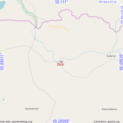
Dzür GPS coordinates[2]
49° 39' 28.656" North, 95° 47' 35.628" East
| Map corner | latitude | longitude |
|---|---|---|
| Upper-left | 50.111°, | 95.09011° |
| Center: | 49.65796°, | 95.79323° |
| Lower-right: | 49.20066°, | 96.49636° |
| Map W x H: | 101.2×101.2 km | = 62.9×62.9mi |
| max Lat: | 51.50725° ⇑10.1% North |
| Dzür: | 49.65796° |
| min Lat: | ⇓89.9% South 42.84199° |
| min Long | Dzür | max Long |
| 89.14358° | 95.79323° | 118.51014° |
| W 18.4%⇐ | ⇒81.6% E |
Elevation
Elevation of Dzür is 1287 m = 4222 ft, and this is 129.5 m = 425 ft below average elevation for this country.
| Max E: |
2800 m = 9186 ft | 58% |
| Avg. | 1416.5 m = 4647 ft | |
| Dzür | 1287 m = 4222 ft | |
Min E: |
619 m = 2031 ft | 42% |
See also: Mongolia elevation on elevation.city.
Geographical zone
Dzür is located in North temperate zone (between Tropic of Cancer and the Arctic Circle). Distance of this North polar circle is 1879.7 km =1168 mi to North.| Distance of | km | miles | from Dzür |
|---|---|---|---|
| North Pole | 4485.6 | 2787.2 | to North |
| Arctic Circle | 1879.7 | 1168 | to North |
| Tropic Cancer | 2915.5 | 1811.6 | to South |
| Equator | 5521.4 | 3430.8 | to South |


Nearby cities:
15 places around Dzür: (largest is in red/bold)
• Altanbulag
55.7 km =34.6 mi,  134°
134°
• Altay
41 km =25.5 mi,  82°
82°
• Asgat
74.4 km =46.2 mi,  102°
102°
• Baruunturuun
100 km =62.1 mi,  270°
270°
• Bugat
143.1 km =88.9 mi,  264°
264°
• Dzel
146.8 km =91.2 mi,  280°
280°
• Halban
141.1 km =87.7 mi, 95°
• Holboo
121.7 km =75.6 mi,  192°
192°
• Hödrögö
121.7 km =75.6 mi,  135°
135°
• Jargalant
46.3 km =28.8 mi,  212°
212°
• Nuga
157.1 km =97.6 mi,  198°
198°
• Oygon
92.4 km =57.4 mi, 143°
• Tegsh
101.9 km =63.3 mi,  171°
171°
• Tsagaanhayrhan
116.2 km =72.2 mi, 255°
• Tsetserleg
80.1 km =49.8 mi,  237°
237°
Sources, notices
• [Note1] Compared only with cities in Mongolia existing in our database
• [Src1] Map data: © OpenStreetMap contributors (CC-BY-SA)
• [Src2] Other city data from geonames.org with taken over terms of usage.
• [Src3] Geographical zone / Annual Mean Temperature by Robert A. Rohde @ Wikipedia
