Floriana geodata
Floriana (Il-Furjana) is a seat of a first-order administrative division; located in Malta in Europe/Malta (GMT+2) time zone. With population of 2,516 people, there are 51 cities with bigger population in this country. Compared to other cities in Malta, 50.7% of cities are located further ↑North; 80.3% of cities are located further ←West and 66.2% of cities have higher elevation than Floriana. Note1


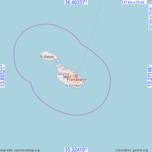
Floriana GPS coordinates[2]
35° 53' 44.988" North, 14° 30' 29.988" East
| Map corner | latitude | longitude |
|---|---|---|
| Upper-left | 36.46337°, | 13.80521° |
| Center: | 35.89583°, | 14.50833° |
| Lower-right: | 35.32419°, | 15.21146° |
| Map W x H: | 126.7×126.7 km | = 78.7×78.7mi |
| max Lat: | 36.07222° ⇑50.7% North |
| Floriana: | 35.89583° |
| min Lat: | ⇓49.3% South 35.82583° |
| min Long | Floriana | max Long |
| 14.20361° | 14.50833° | 14.56701° |
| W 80.3%⇐ | ⇒19.7% E |
Elevation
Elevation of Floriana is 47 m = 154 ft, and this is 31.1 m = 102 ft below average elevation for this country.
| Max E: |
231 m = 758 ft | 66.2% |
| Avg. | 78.1 m = 256 ft | |
| Floriana | 47 m = 154 ft | |
Min E: |
5 m = 16 ft | 33.8% |
See also: Malta elevation on elevation.city.
Geographical zone
Floriana is located in North temperate zone (between Tropic of Cancer and the Arctic Circle). Distance of this Northern Tropic circle is 1385.3 km =860.8 mi to South.| Distance of | km | miles | from Floriana |
|---|---|---|---|
| North Pole | 6015.8 | 3738 | to North |
| Arctic Circle | 3409.9 | 2118.8 | to North |
| Tropic Cancer | 1385.3 | 860.8 | to South |
| Equator | 3991.2 | 2480 | to South |


Nearby cities:
15 places around Floriana: (largest is in red/bold)
• Cospicua
2.1 km =1.3 mi,  123°
123°
• Fgura
2.9 km =1.8 mi,  170°
170°
• Gżira
2.1 km =1.3 mi,  301°
301°
• Imsida
2.3 km =1.4 mi,  260°
260°
• Kalkara
2.3 km =1.4 mi,  108°
108°
• Marsa
2.2 km =1.4 mi,  212°
212°
• Paola
2.7 km =1.7 mi,  198°
198°
• Pietà
1.2 km =0.7 mi, 264°
• San Ġiljan
3 km =1.9 mi,  326°
326°
• Senglea
1.2 km =0.7 mi,  140°
140°
• Sliema
1.9 km =1.2 mi,  342°
342°
• Ta’ Xbiex
1.3 km =0.8 mi,  286°
286°
• Valletta
0.7 km =0.4 mi,  53°
53°
• Vittoriosa
1 km =0.6 mi, 114°
• Ħamrun
2.5 km =1.6 mi,  240°
240°
Sources, notices
• [Note1] Compared only with cities in Malta existing in our database
• [Src1] Map data: © OpenStreetMap contributors (CC-BY-SA)
• [Src2] Other city data from geonames.org with taken over terms of usage.
• [Src3] Geographical zone / Annual Mean Temperature by Robert A. Rohde @ Wikipedia
