Sprachcaffe geodata
Sprachcaffe (Pembroke) is a populated place; located in Malta in Europe/Malta (GMT+2) time zone. With population of 750 people, there are 67 cities with bigger population in this country. Compared to other cities in Malta, 71.8% of cities are located further ↓South; 57.7% of cities are located further ←West and 60.6% of cities have higher elevation than Sprachcaffe. Note1


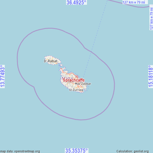
Sprachcaffe GPS coordinates[2]
35° 55' 30.612" North, 14° 28' 40.98" East
| Map corner | latitude | longitude |
|---|---|---|
| Upper-left | 36.4925°, | 13.77493° |
| Center: | 35.92517°, | 14.47805° |
| Lower-right: | 35.35375°, | 15.18118° |
| Map W x H: | 126.6×126.6 km | = 78.7×78.7mi |
| max Lat: | 36.07222° ⇑28.2% North |
| Sprachcaffe: | 35.92517° |
| min Lat: | ⇓71.8% South 35.82583° |
| min Long | Sprachcaffe | max Long |
| 14.20361° | 14.47805° | 14.56701° |
| W 57.7%⇐ | ⇒42.3% E |
Elevation
Elevation of Sprachcaffe is 56 m = 184 ft, and this is 22.1 m = 73 ft below average elevation for this country.
| Max E: |
231 m = 758 ft | 60.6% |
| Avg. | 78.1 m = 256 ft | |
| Sprachcaffe | 56 m = 184 ft | |
Min E: |
5 m = 16 ft | 39.4% |
See also: Malta elevation on elevation.city.
Geographical zone
Sprachcaffe is located in North temperate zone (between Tropic of Cancer and the Arctic Circle). Distance of this Northern Tropic circle is 1388.6 km =862.8 mi to South.| Distance of | km | miles | from Sprachcaffe |
|---|---|---|---|
| North Pole | 6012.6 | 3736.1 | to North |
| Arctic Circle | 3406.7 | 2116.8 | to North |
| Tropic Cancer | 1388.6 | 862.8 | to South |
| Equator | 3994.5 | 2482.1 | to South |


Nearby cities:
15 places around Sprachcaffe: (largest is in red/bold)
• Balzan
3.5 km =2.2 mi,  216°
216°
• Birkirkara
3.5 km =2.2 mi,  206°
206°
• Gżira
2.3 km =1.4 mi,  157°
157°
• Hal Gharghur
2.4 km =1.5 mi,  267°
267°
• Imsida
3.7 km =2.3 mi,  173°
173°
• L-Iklin
3.2 km =2 mi, 222°
• Naxxar
3.4 km =2.1 mi,  247°
247°
• Pembroke
0.6 km =0.4 mi,  345°
345°
• Pietà
3.7 km =2.3 mi, 155°
• Saint John
2.2 km =1.4 mi,  184°
184°
• San Ġiljan
1.3 km =0.8 mi,  125°
125°
• Santa Venera
3.8 km =2.4 mi,  185°
185°
• Sliema
2.6 km =1.6 mi,  123°
123°
• Swieqi
0.3 km =0.2 mi,  149°
149°
• Ta’ Xbiex
3.2 km =2 mi, 152°
Sources, notices
• [Note1] Compared only with cities in Malta existing in our database
• [Src1] Map data: © OpenStreetMap contributors (CC-BY-SA)
• [Src2] Other city data from geonames.org with taken over terms of usage.
• [Src3] Geographical zone / Annual Mean Temperature by Robert A. Rohde @ Wikipedia
