Souillac geodata
Souillac (Savanne) is a seat of a first-order administrative division; located in Mauritius in Indian/Mauritius (GMT+4) time zone. With population of 4,392 people, there are 56 cities with bigger population in this country. Compared to other cities in Mauritius, 100% of cities are located further ↑North; 78.8% of cities are located further →East and 87.9% of cities have higher elevation than Souillac. Note1


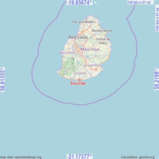
Souillac GPS coordinates[2]
20° 31' 0.012" South, 57° 31' 0.012" East
| Map corner | latitude | longitude |
|---|---|---|
| Upper-left | -19.85674°, | 56.81355° |
| Center: | -20.51667°, | 57.51667° |
| Lower-right: | -21.17377°, | 58.2198° |
| Map W x H: | 146.4×146.4 km | = 91×91mi |
| max Lat: | -10.38803° ⇑100% North |
| Souillac: | -20.51667° |
| min Lat: | ⇓0% South -20.51667° |
| min Long | Souillac | max Long |
| 56.61795° | 57.51667° | 63.41667° |
| W 21.2%⇐ | ⇒78.8% E |
Elevation
Elevation of Souillac is 18 m = 59 ft, and this is 134.1 m = 440 ft below average elevation for this country.
| Max E: |
467 m = 1532 ft | 87.9% |
| Avg. | 152.1 m = 499 ft | |
| Souillac | 18 m = 59 ft | |
Min E: |
1 m = 3 ft | 12.1% |
See also: Mauritius elevation on elevation.city.
Geographical zone
Souillac is located in South Torrid zone (between Equator and Tropic of Capricorn). Distance of this Southern Tropic circle is 324.7 km =201.8 mi to South.| Distance of | km | miles | from Souillac |
|---|---|---|---|
| Equator | 2281.2 | 1417.5 | to North |
| Tropic Capricorn | 324.7 | 201.8 | to South |
| Antarctic Circle | 5119.9 | 3181.4 | to South |
| South Pole | 7725.8 | 4800.6 | to South |


Nearby cities:
15 places around Souillac: (largest is in red/bold)
• Bananes
20.3 km =12.6 mi,  21°
21°
• Camp Diable
8.8 km =5.5 mi,  47°
47°
• Chamarel
17.3 km =10.7 mi,  307°
307°
• Chamouny
6.5 km =4 mi, 306°
• Chemin Grenier
6.2 km =3.9 mi,  301°
301°
• Cluny
19 km =11.8 mi,  28°
28°
• Grand Bois
11.2 km =7 mi,  14°
14°
• New Grove
15.7 km =9.8 mi,  40°
40°
• Nouvelle France
16.9 km =10.5 mi, 15°
• Petite Case Noyale
20.9 km =13 mi, 311°
• Plaine Magnien
18.6 km =11.6 mi,  58°
58°
• Rivière des Anguilles
5 km =3.1 mi, 45°
• Rose Belle
15.4 km =9.6 mi, 32°
• Saint Aubin
4.2 km =2.6 mi, 56°
• Surinam
1.4 km =0.9 mi, 303°
Sources, notices
• [Note1] Compared only with cities in Mauritius existing in our database
• [Src1] Map data: © OpenStreetMap contributors (CC-BY-SA)
• [Src2] Other city data from geonames.org with taken over terms of usage.
• [Src3] Geographical zone / Annual Mean Temperature by Robert A. Rohde @ Wikipedia
