Quatre Soeurs geodata
Quatre Soeurs (Flacq) is a populated place; located in Mauritius in Indian/Mauritius (GMT+4) time zone. With population of 3,515 people, there are 64 cities with bigger population in this country. Compared to other cities in Mauritius, 72.7% of cities are located further ↑North; 94.9% of cities are located further ←West and 89.9% of cities have higher elevation than Quatre Soeurs. Note1


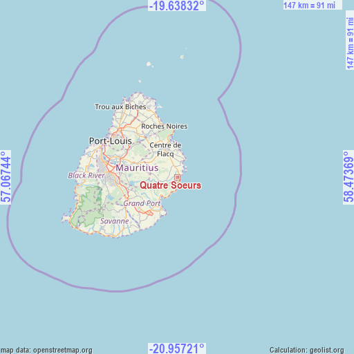
Quatre Soeurs GPS coordinates[2]
20° 17' 57.012" South, 57° 46' 14.016" East
| Map corner | latitude | longitude |
|---|---|---|
| Upper-left | -19.63832°, | 57.06744° |
| Center: | -20.29917°, | 57.77056° |
| Lower-right: | -20.95721°, | 58.47369° |
| Map W x H: | 146.6×146.6 km | = 91.1×91.1mi |
| max Lat: | -10.38803° ⇑72.7% North |
| Quatre Soeurs: | -20.29917° |
| min Lat: | ⇓27.3% South -20.51667° |
| min Long | Quatre Soeurs | max Long |
| 56.61795° | 57.77056° | 63.41667° |
| W 94.9%⇐ | ⇒5.1% E |
Elevation
Elevation of Quatre Soeurs is 15 m = 49 ft, and this is 137.1 m = 450 ft below average elevation for this country.
| Max E: |
467 m = 1532 ft | 89.9% |
| Avg. | 152.1 m = 499 ft | |
| Quatre Soeurs | 15 m = 49 ft | |
Min E: |
1 m = 3 ft | 10.1% |
See also: Mauritius elevation on elevation.city.
Geographical zone
Quatre Soeurs is located in South Torrid zone (between Equator and Tropic of Capricorn). Distance of this Southern Tropic circle is 348.9 km =216.8 mi to South.| Distance of | km | miles | from Quatre Soeurs |
|---|---|---|---|
| Equator | 2257.1 | 1402.5 | to North |
| Tropic Capricorn | 348.9 | 216.8 | to South |
| Antarctic Circle | 5144.1 | 3196.4 | to South |
| South Pole | 7750 | 4815.6 | to South |


Nearby cities:
15 places around Quatre Soeurs: (largest is in red/bold)
• Bambous Virieux
5 km =3.1 mi,  195°
195°
• Bel Air Rivière Sèche
5.1 km =3.2 mi,  334°
334°
• Bois des Amourettes
8.2 km =5.1 mi,  210°
210°
• Camp Ithier
9.6 km =6 mi,  344°
344°
• Camp de Masque
13.2 km =8.2 mi,  301°
301°
• Clémencia
7.8 km =4.8 mi, 300°
• Ecroignard
8.9 km =5.5 mi, 336°
• Grand Sable
1.8 km =1.1 mi, 200°
• Grande Rivière Sud Est
1.6 km =1 mi,  20°
20°
• Mare La Chaux
11.5 km =7.1 mi,  348°
348°
• Montagne Blanche
11.8 km =7.3 mi,  277°
277°
• Olivia
4.3 km =2.7 mi,  287°
287°
• Quatre Cocos
10.9 km =6.8 mi,  2°
2°
• Queen Victoria
11 km =6.8 mi,  323°
323°
• Sebastopol
8.7 km =5.4 mi, 276°
Sources, notices
• [Note1] Compared only with cities in Mauritius existing in our database
• [Src1] Map data: © OpenStreetMap contributors (CC-BY-SA)
• [Src2] Other city data from geonames.org with taken over terms of usage.
• [Src3] Geographical zone / Annual Mean Temperature by Robert A. Rohde @ Wikipedia
