Olivia geodata
Olivia (Flacq) is a populated place; located in Mauritius in Indian/Mauritius (GMT+4) time zone. With population of 3,980 people, there are 59 cities with bigger population in this country. Compared to other cities in Mauritius, 69.7% of cities are located further ↑North; 86.9% of cities are located further ←West and 51.5% of cities have higher elevation than Olivia. Note1


Olivia GPS coordinates[2]
20° 17' 16.008" South, 57° 43' 51.492" East
| Map corner | latitude | longitude |
|---|---|---|
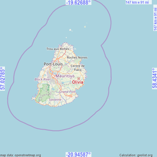
| Upper-left | -19.62688°, | 57.02785° |
| Center: | -20.28778°, | 57.73097° |
| Lower-right: | -20.94587°, | 58.4341° |
| Map W x H: | 146.7×146.7 km | = 91.2×91.2mi |
| max Lat: | -10.38803° ⇑69.7% North |
| Olivia: | -20.28778° |
| min Lat: | ⇓30.3% South -20.51667° |
| min Long | Olivia | max Long |
| 56.61795° | 57.73097° | 63.41667° |
| W 86.9%⇐ | ⇒13.1% E |
Elevation
Elevation of Olivia is 106 m = 348 ft, and this is 46.1 m = 151 ft below average elevation for this country.
| Max E: |
467 m = 1532 ft | 51.5% |
| Avg. | 152.1 m = 499 ft | |
| Olivia | 106 m = 348 ft | |
Min E: |
1 m = 3 ft | 48.5% |
See also: Mauritius elevation on elevation.city.
Geographical zone
Olivia is located in South Torrid zone (between Equator and Tropic of Capricorn). Distance of this Southern Tropic circle is 350.1 km =217.5 mi to South.| Distance of | km | miles | from Olivia |
|---|---|---|---|
| Equator | 2255.8 | 1401.7 | to North |
| Tropic Capricorn | 350.1 | 217.5 | to South |
| Antarctic Circle | 5145.4 | 3197.2 | to South |
| South Pole | 7751.3 | 4816.4 | to South |


Nearby cities:
15 places around Olivia: (largest is in red/bold)
• Bambous Virieux
6.7 km =4.2 mi,  155°
155°
• Bel Air Rivière Sèche
3.9 km =2.4 mi,  30°
30°
• Bois des Amourettes
8.4 km =5.2 mi,  179°
179°
• Camp Ithier
8.1 km =5 mi,  10°
10°
• Camp de Masque
9 km =5.6 mi,  308°
308°
• Clémencia
3.7 km =2.3 mi,  315°
315°
• Ecroignard
6.9 km =4.3 mi,  4°
4°
• Grand Sable
4.6 km =2.9 mi,  130°
130°
• Grande Rivière Sud Est
4.7 km =2.9 mi,  87°
87°
• Mare La Chaux
10.2 km =6.3 mi, 10°
• Melrose
10.5 km =6.5 mi,  281°
281°
• Montagne Blanche
7.5 km =4.7 mi,  272°
272°
• Quatre Soeurs
4.3 km =2.7 mi,  107°
107°
• Queen Victoria
7.9 km =4.9 mi,  342°
342°
• Sebastopol
4.5 km =2.8 mi, 265°
Sources, notices
• [Note1] Compared only with cities in Mauritius existing in our database
• [Src1] Map data: © OpenStreetMap contributors (CC-BY-SA)
• [Src2] Other city data from geonames.org with taken over terms of usage.
• [Src3] Geographical zone / Annual Mean Temperature by Robert A. Rohde @ Wikipedia
