Tlacohuaque geodata
Tlacohuaque (San Luis Potosí) is a populated place; located in Mexico in America/Mexico_City (GMT-6) time zone. With population of 593 people, there are 14492 cities with bigger population in this country. Compared to other cities in Mexico, 80.4% of cities are located further ↓South; 51.8% of cities are located further ←West and 75.5% of cities have higher elevation than Tlacohuaque. Note1


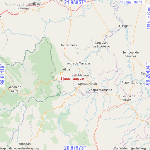
Tlacohuaque GPS coordinates[2]
21° 20' 9.996" North, 98° 54' 29.016" West
| Map corner | latitude | longitude |
|---|---|---|
| Upper-left | 21.98957°, | -99.61119° |
| Center: | 21.33611°, | -98.90806° |
| Lower-right: | 20.67973°, | -98.20494° |
| Map W x H: | 145.6×145.6 km | = 90.5×90.5mi |
| max Lat: | 32.7° ⇑19.6% North |
| Tlacohuaque: | 21.33611° |
| min Lat: | ⇓80.4% South 14.53588° |
| min Long | Tlacohuaque | max Long |
| -117.105° | -98.90806° | -86.73105° |
| W 51.8%⇐ | ⇒48.2% E |
Elevation
Elevation of Tlacohuaque is 204 m = 669 ft, and this is 1049.7 m = 3444 ft below average elevation for this country.
| Max E: |
3497 m = 11473 ft | 75.5% |
| Avg. | 1253.7 m = 4113 ft | |
| Tlacohuaque | 204 m = 669 ft | |
Min E: |
-1 m = -3 ft | 24.5% |
See also: Mexico elevation on elevation.city.
Geographical zone
Tlacohuaque is located in North Torrid zone (between Equator and Tropic of Cancer). Distance of this Northern Tropic circle is 233.6 km =145.2 mi to North.| Distance of | km | miles | from Tlacohuaque |
|---|---|---|---|
| North Pole | 7634.7 | 4744 | to North |
| Arctic Circle | 5028.8 | 3124.8 | to North |
| Tropic Cancer | 233.6 | 145.2 | to North |
| Equator | 2372.4 | 1474.1 | to South |


Nearby cities:
15 places around Tlacohuaque: (largest is in red/bold)
• Ahuehueyo Primero Centro
7.4 km =4.6 mi,  82°
82°
• Barrio de En Medio
7.4 km =4.6 mi,  89°
89°
• Coaquentla
3.1 km =1.9 mi,  153°
153°
• Cuartillo Nuevo
4.1 km =2.5 mi,  299°
299°
• Iztacapa
5.1 km =3.2 mi,  317°
317°
• Las Cuevas
4.6 km =2.9 mi,  48°
48°
• Las Moras
6.6 km =4.1 mi,  216°
216°
• Pahuayo Primero
2.3 km =1.4 mi,  142°
142°
• Pemoxco
4.3 km =2.7 mi,  311°
311°
• Pilateno
6.3 km =3.9 mi,  265°
265°
• Sabino
6.6 km =4.1 mi,  253°
253°
• San Francisco
6.5 km =4 mi,  163°
163°
• Tenexio
5.4 km =3.4 mi,  33°
33°
• Zacayo
2.1 km =1.3 mi,  194°
194°
• Zapuyo
2.5 km =1.6 mi,  326°
326°
Sources, notices
• [Note1] Compared only with cities in Mexico existing in our database
• [Src1] Map data: © OpenStreetMap contributors (CC-BY-SA)
• [Src2] Other city data from geonames.org with taken over terms of usage.
• [Src3] Geographical zone / Annual Mean Temperature by Robert A. Rohde @ Wikipedia
