Coaquentla geodata
Coaquentla (San Luis Potosí) is a populated place; located in Mexico in America/Mexico_City (GMT-6) time zone. With population of 571 people, there are 14980 cities with bigger population in this country. Compared to other cities in Mexico, 80.1% of cities are located further ↓South; 52.1% of cities are located further ←West and 66.5% of cities have higher elevation than Coaquentla. Note1


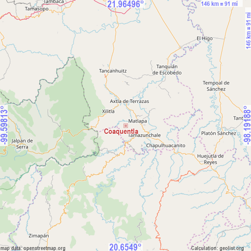
Coaquentla GPS coordinates[2]
21° 18' 41.004" North, 98° 53' 42" West
| Map corner | latitude | longitude |
|---|---|---|
| Upper-left | 21.96496°, | -99.59813° |
| Center: | 21.31139°, | -98.895° |
| Lower-right: | 20.6549°, | -98.19188° |
| Map W x H: | 145.7×145.7 km | = 90.5×90.5mi |
| max Lat: | 32.7° ⇑19.9% North |
| Coaquentla: | 21.31139° |
| min Lat: | ⇓80.1% South 14.53588° |
| min Long | Coaquentla | max Long |
| -117.105° | -98.895° | -86.73105° |
| W 52.1%⇐ | ⇒47.9% E |
Elevation
Elevation of Coaquentla is 611 m = 2005 ft, and this is 642.7 m = 2109 ft below average elevation for this country.
| Max E: |
3497 m = 11473 ft | 66.5% |
| Avg. | 1253.7 m = 4113 ft | |
| Coaquentla | 611 m = 2005 ft | |
Min E: |
-1 m = -3 ft | 33.5% |
See also: Mexico elevation on elevation.city.
Geographical zone
Coaquentla is located in North Torrid zone (between Equator and Tropic of Cancer). Distance of this Northern Tropic circle is 236.3 km =146.8 mi to North.| Distance of | km | miles | from Coaquentla |
|---|---|---|---|
| North Pole | 7637.5 | 4745.7 | to North |
| Arctic Circle | 5031.6 | 3126.5 | to North |
| Tropic Cancer | 236.3 | 146.8 | to North |
| Equator | 2369.6 | 1472.4 | to South |


Nearby cities:
15 places around Coaquentla: (largest is in red/bold)
• Ahuehueyo Primero Centro
7.1 km =4.4 mi,  58°
58°
• Atlamaxátl
7.2 km =4.5 mi,  90°
90°
• Barrio de Arriba
7.2 km =4.5 mi,  71°
71°
• Barrio de En Medio
6.7 km =4.2 mi, 64°
• Coyol (Vega Larga)
6.6 km =4.1 mi,  138°
138°
• Cuartillo Nuevo
6.8 km =4.2 mi,  314°
314°
• La Arena
7.1 km =4.4 mi,  232°
232°
• Las Cuevas
6.2 km =3.9 mi,  19°
19°
• Las Moras
5.9 km =3.7 mi,  244°
244°
• Pahuayo Primero
1 km =0.6 mi,  1°
1°
• Pemoxco
7.2 km =4.5 mi,  320°
320°
• San Francisco
3.6 km =2.2 mi,  172°
172°
• Tlacohuaque
3.1 km =1.9 mi,  333°
333°
• Zacayo
2 km =1.2 mi,  291°
291°
• Zapuyo
5.5 km =3.4 mi, 330°
Sources, notices
• [Note1] Compared only with cities in Mexico existing in our database
• [Src1] Map data: © OpenStreetMap contributors (CC-BY-SA)
• [Src2] Other city data from geonames.org with taken over terms of usage.
• [Src3] Geographical zone / Annual Mean Temperature by Robert A. Rohde @ Wikipedia
