Escoatitla geodata
Escoatitla (San Luis Potosí) is a populated place; located in Mexico in America/Mexico_City (GMT-6) time zone. With population of 770 people, there are 11354 cities with bigger population in this country. Compared to other cities in Mexico, 80.3% of cities are located further ↓South; 55.1% of cities are located further ←West and 71.9% of cities have higher elevation than Escoatitla. Note1


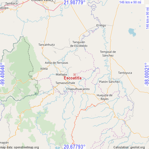
Escoatitla GPS coordinates[2]
21° 20' 3.552" North, 98° 42' 11.988" West
| Map corner | latitude | longitude |
|---|---|---|
| Upper-left | 21.98779°, | -99.40646° |
| Center: | 21.33432°, | -98.70333° |
| Lower-right: | 20.67793°, | -98.00021° |
| Map W x H: | 145.6×145.6 km | = 90.5×90.5mi |
| max Lat: | 32.7° ⇑19.7% North |
| Escoatitla: | 21.33432° |
| min Lat: | ⇓80.3% South 14.53588° |
| min Long | Escoatitla | max Long |
| -117.105° | -98.70333° | -86.73105° |
| W 55.1%⇐ | ⇒44.9% E |
Elevation
Elevation of Escoatitla is 331 m = 1086 ft, and this is 922.7 m = 3027 ft below average elevation for this country.
| Max E: |
3497 m = 11473 ft | 71.9% |
| Avg. | 1253.7 m = 4113 ft | |
| Escoatitla | 331 m = 1086 ft | |
Min E: |
-1 m = -3 ft | 28.1% |
See also: Mexico elevation on elevation.city.
Geographical zone
Escoatitla is located in North Torrid zone (between Equator and Tropic of Cancer). Distance of this Northern Tropic circle is 233.8 km =145.3 mi to North.| Distance of | km | miles | from Escoatitla |
|---|---|---|---|
| North Pole | 7634.9 | 4744.1 | to North |
| Arctic Circle | 5029 | 3124.9 | to North |
| Tropic Cancer | 233.8 | 145.3 | to North |
| Equator | 2372.2 | 1474 | to South |


Nearby cities:
15 places around Escoatitla: (largest is in red/bold)
• Chiconamel
4.1 km =2.5 mi,  336°
336°
• Chililillo
8.6 km =5.3 mi,  323°
323°
• Cuixcuatitla
7.8 km =4.8 mi,  239°
239°
• El Huexco
5.2 km =3.2 mi,  277°
277°
• El Tepetate
6.5 km =4 mi,  225°
225°
• La Cichilla
5.8 km =3.6 mi,  202°
202°
• La Soledad
6.7 km =4.2 mi, 341°
• Macuilocatl
6.7 km =4.2 mi,  329°
329°
• Manchoc
1.5 km =0.9 mi,  45°
45°
• Ocuiltzapoyo
2.8 km =1.7 mi,  247°
247°
• San Martín Chalchicuautla
6.3 km =3.9 mi, 50°
• Tampacán
8 km =5 mi, 341°
• Tenextitla Dos
4.1 km =2.5 mi,  353°
353°
• Totomoxtla (La Ceiba)
7.9 km =4.9 mi,  307°
307°
• Xochicuatla
4.2 km =2.6 mi, 309°
Sources, notices
• [Note1] Compared only with cities in Mexico existing in our database
• [Src1] Map data: © OpenStreetMap contributors (CC-BY-SA)
• [Src2] Other city data from geonames.org with taken over terms of usage.
• [Src3] Geographical zone / Annual Mean Temperature by Robert A. Rohde @ Wikipedia
