La Cichilla geodata
La Cichilla (San Luis Potosí) is a populated place; located in Mexico in America/Mexico_City (GMT-6) time zone. With population of 508 people, there are 16554 cities with bigger population in this country. Compared to other cities in Mexico, 79.9% of cities are located further ↓South; 54.7% of cities are located further ←West and 78.6% of cities have higher elevation than La Cichilla. Note1


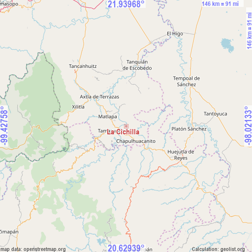
La Cichilla GPS coordinates[2]
21° 17' 9.564" North, 98° 43' 28.02" West
| Map corner | latitude | longitude |
|---|---|---|
| Upper-left | 21.93968°, | -99.42758° |
| Center: | 21.28599°, | -98.72445° |
| Lower-right: | 20.62939°, | -98.02133° |
| Map W x H: | 145.7×145.7 km | = 90.5×90.5mi |
| max Lat: | 32.7° ⇑20.1% North |
| La Cichilla: | 21.28599° |
| min Lat: | ⇓79.9% South 14.53588° |
| min Long | La Cichilla | max Long |
| -117.105° | -98.72445° | -86.73105° |
| W 54.7%⇐ | ⇒45.3% E |
Elevation
Elevation of La Cichilla is 119 m = 390 ft, and this is 1134.7 m = 3723 ft below average elevation for this country.
| Max E: |
3497 m = 11473 ft | 78.6% |
| Avg. | 1253.7 m = 4113 ft | |
| La Cichilla | 119 m = 390 ft | |
Min E: |
-1 m = -3 ft | 21.4% |
See also: Mexico elevation on elevation.city.
Geographical zone
La Cichilla is located in North Torrid zone (between Equator and Tropic of Cancer). Distance of this Northern Tropic circle is 239.1 km =148.6 mi to North.| Distance of | km | miles | from La Cichilla |
|---|---|---|---|
| North Pole | 7640.3 | 4747.5 | to North |
| Arctic Circle | 5034.4 | 3128.2 | to North |
| Tropic Cancer | 239.1 | 148.6 | to North |
| Equator | 2366.8 | 1470.7 | to South |


Nearby cities:
15 places around La Cichilla: (largest is in red/bold)
• Chalchocoyo
7.7 km =4.8 mi,  294°
294°
• Cojolapa
7.3 km =4.5 mi,  164°
164°
• Cuixcuatitla
4.7 km =2.9 mi, 287°
• El Huexco
6.8 km =4.2 mi,  333°
333°
• El Palmito
4.4 km =2.7 mi, 158°
• El Piñal
4.7 km =2.9 mi,  213°
213°
• El Tepetate
2.5 km =1.6 mi, 288°
• Escoatitla
5.8 km =3.6 mi,  22°
22°
• Ixteamel
7.5 km =4.7 mi,  267°
267°
• Ixtlapalaco
5 km =3.1 mi,  246°
246°
• Manchoc
7.2 km =4.5 mi,  27°
27°
• Ocuiltzapoyo
4.3 km =2.7 mi,  354°
354°
• Tamazunchale
7.3 km =4.5 mi, 246°
• Temamatla
6.9 km =4.3 mi, 214°
• Tezontla
5.9 km =3.7 mi,  150°
150°
Sources, notices
• [Note1] Compared only with cities in Mexico existing in our database
• [Src1] Map data: © OpenStreetMap contributors (CC-BY-SA)
• [Src2] Other city data from geonames.org with taken over terms of usage.
• [Src3] Geographical zone / Annual Mean Temperature by Robert A. Rohde @ Wikipedia
