Xopanapa geodata
Xopanapa (Puebla) is a populated place; located in Mexico in America/Mexico_City (GMT-6) time zone. With population of 781 people, there are 11181 cities with bigger population in this country. Compared to other cities in Mexico, 61.1% of cities are located further ↑North; 73.5% of cities are located further ←West and 79.8% of cities have lower elevation than Xopanapa. Note1


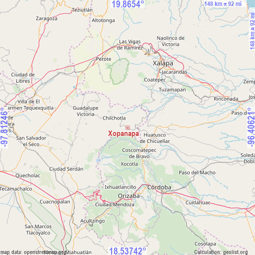
Xopanapa GPS coordinates[2]
19° 12' 9.9" North, 97° 6' 33.588" West
| Map corner | latitude | longitude |
|---|---|---|
| Upper-left | 19.8654°, | -97.81246° |
| Center: | 19.20275°, | -97.10933° |
| Lower-right: | 18.53742°, | -96.40621° |
| Map W x H: | 147.7×147.7 km | = 91.8×91.8mi |
| max Lat: | 32.7° ⇑61.1% North |
| Xopanapa: | 19.20275° |
| min Lat: | ⇓38.9% South 14.53588° |
| min Long | Xopanapa | max Long |
| -117.105° | -97.10933° | -86.73105° |
| W 73.5%⇐ | ⇒26.5% E |
Elevation
Elevation of Xopanapa is 2135 m = 7005 ft, and this is 881.3 m = 2891 ft above average elevation for this country.
| Max E: |
3497 m = 11473 ft | 20.2% |
| Xopanapa | 2135 m 7005 ft | |
| Avg. | 1253.7 m = 4113 ft | |
Min E: |
-1 m = -3 ft | 79.8% |
See also: Mexico elevation on elevation.city.
Geographical zone
Xopanapa is located in North Torrid zone (between Equator and Tropic of Cancer). Distance of this Northern Tropic circle is 470.8 km =292.5 mi to North.| Distance of | km | miles | from Xopanapa |
|---|---|---|---|
| North Pole | 7871.9 | 4891.4 | to North |
| Arctic Circle | 5266 | 3272.1 | to North |
| Tropic Cancer | 470.8 | 292.5 | to North |
| Equator | 2135.1 | 1326.7 | to South |


Nearby cities:
15 places around Xopanapa: (largest is in red/bold)
• Acalocotla
2.8 km =1.7 mi,  184°
184°
• Atlaxco
2.7 km =1.7 mi,  129°
129°
• Chichiquila
4.5 km =2.8 mi,  92°
92°
• Colonia la Concepción
5.5 km =3.4 mi,  21°
21°
• Dos Ríos
4.1 km =2.5 mi,  120°
120°
• El Rosario
4.2 km =2.6 mi,  56°
56°
• Huaxcaleca
4.9 km =3 mi,  44°
44°
• Jesús María Acatla
2.9 km =1.8 mi,  241°
241°
• Ojo de Agua
0.7 km =0.4 mi,  304°
304°
• Papalotla
3.5 km =2.2 mi,  288°
288°
• San José Acatla
1.7 km =1.1 mi,  220°
220°
• Tizapa
5 km =3.1 mi, 132°
• Tlanepantla
3.1 km =1.9 mi, 302°
• Xacaxomulco
4.3 km =2.7 mi,  248°
248°
• Xochimilco
0.7 km =0.4 mi,  47°
47°
Sources, notices
• [Note1] Compared only with cities in Mexico existing in our database
• [Src1] Map data: © OpenStreetMap contributors (CC-BY-SA)
• [Src2] Other city data from geonames.org with taken over terms of usage.
• [Src3] Geographical zone / Annual Mean Temperature by Robert A. Rohde @ Wikipedia
