Jesús María Acatla geodata
Jesús María Acatla (Puebla) is a populated place; located in Mexico in America/Mexico_City (GMT-6) time zone. With population of 688 people, there are 12631 cities with bigger population in this country. Compared to other cities in Mexico, 61.4% of cities are located further ↑North; 73.2% of cities are located further ←West and 83.3% of cities have lower elevation than Jesús María Acatla. Note1


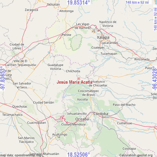
Jesús María Acatla GPS coordinates[2]
19° 11' 25.584" North, 97° 8' 0.24" West
| Map corner | latitude | longitude |
|---|---|---|
| Upper-left | 19.85314°, | -97.83653° |
| Center: | 19.19044°, | -97.1334° |
| Lower-right: | 18.52506°, | -96.43028° |
| Map W x H: | 147.7×147.7 km | = 91.8×91.8mi |
| max Lat: | 32.7° ⇑61.4% North |
| Jesús María Acatla: | 19.19044° |
| min Lat: | ⇓38.6% South 14.53588° |
| min Long | Jesús María A | max Long |
| -117.105° | -97.1334° | -86.73105° |
| W 73.2%⇐ | ⇒26.8% E |
Elevation
Elevation of Jesús María Acatla is 2226 m = 7303 ft, and this is 972.3 m = 3190 ft above average elevation for this country.
| Max E: |
3497 m = 11473 ft | 16.7% |
| Jesús María Acatla | 2226 m 7303 ft | |
| Avg. | 1253.7 m = 4113 ft | |
Min E: |
-1 m = -3 ft | 83.3% |
See also: Mexico elevation on elevation.city.
Geographical zone
Jesús María Acatla is located in North Torrid zone (between Equator and Tropic of Cancer). Distance of this Northern Tropic circle is 472.1 km =293.3 mi to North.| Distance of | km | miles | from Jesús María Acatla |
|---|---|---|---|
| North Pole | 7873.3 | 4892.2 | to North |
| Arctic Circle | 5267.4 | 3273 | to North |
| Tropic Cancer | 472.1 | 293.3 | to North |
| Equator | 2133.8 | 1325.9 | to South |


Nearby cities:
15 places around Jesús María Acatla: (largest is in red/bold)
• Acalocotla
2.7 km =1.7 mi,  122°
122°
• Atlaxco
4.6 km =2.9 mi,  94°
94°
• Cruz Verde
6.4 km =4 mi,  156°
156°
• Dos Ríos
6.1 km =3.8 mi,  96°
96°
• El Triunfo
5.6 km =3.5 mi,  315°
315°
• Excola
5.9 km =3.7 mi,  168°
168°
• Ojo de Agua
2.6 km =1.6 mi,  48°
48°
• Papalotla
2.6 km =1.6 mi,  341°
341°
• Rincón de los Reyes
2.9 km =1.8 mi,  278°
278°
• San José Acatla
1.4 km =0.9 mi, 88°
• Tlanepantla
3 km =1.9 mi,  358°
358°
• Xacaxomulco
1.4 km =0.9 mi,  262°
262°
• Xilomichi
6.3 km =3.9 mi,  186°
186°
• Xochimilco
3.6 km =2.2 mi,  58°
58°
• Xopanapa
2.9 km =1.8 mi, 61°
Sources, notices
• [Note1] Compared only with cities in Mexico existing in our database
• [Src1] Map data: © OpenStreetMap contributors (CC-BY-SA)
• [Src2] Other city data from geonames.org with taken over terms of usage.
• [Src3] Geographical zone / Annual Mean Temperature by Robert A. Rohde @ Wikipedia
