Dos Ríos geodata
Dos Ríos (Puebla) is a populated place; located in Mexico in America/Mexico_City (GMT-6) time zone. With population of 586 people, there are 14641 cities with bigger population in this country. Compared to other cities in Mexico, 61.5% of cities are located further ↑North; 73.9% of cities are located further ←West and 61% of cities have lower elevation than Dos Ríos. Note1


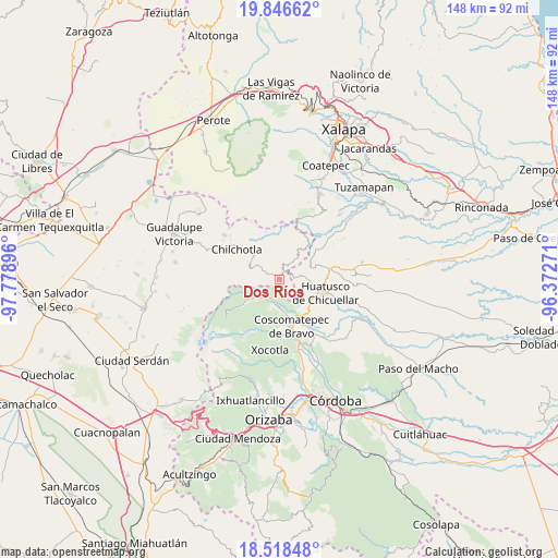
Dos Ríos GPS coordinates[2]
19° 11' 2.004" North, 97° 4' 32.988" West
| Map corner | latitude | longitude |
|---|---|---|
| Upper-left | 19.84662°, | -97.77896° |
| Center: | 19.18389°, | -97.07583° |
| Lower-right: | 18.51848°, | -96.37271° |
| Map W x H: | 147.7×147.7 km | = 91.8×91.8mi |
| max Lat: | 32.7° ⇑61.5% North |
| Dos Ríos: | 19.18389° |
| min Lat: | ⇓38.5% South 14.53588° |
| min Long | Dos Ríos | max Long |
| -117.105° | -97.07583° | -86.73105° |
| W 73.9%⇐ | ⇒26.1% E |
Elevation
Elevation of Dos Ríos is 1743 m = 5719 ft, and this is 489.3 m = 1605 ft above average elevation for this country.
| Max E: |
3497 m = 11473 ft | 39% |
| Dos Ríos | 1743 m 5719 ft | |
| Avg. | 1253.7 m = 4113 ft | |
Min E: |
-1 m = -3 ft | 61% |
See also: Mexico elevation on elevation.city.
Geographical zone
Dos Ríos is located in North Torrid zone (between Equator and Tropic of Cancer). Distance of this Northern Tropic circle is 472.9 km =293.8 mi to North.| Distance of | km | miles | from Dos Ríos |
|---|---|---|---|
| North Pole | 7874 | 4892.7 | to North |
| Arctic Circle | 5268.1 | 3273.4 | to North |
| Tropic Cancer | 472.9 | 293.8 | to North |
| Equator | 2133 | 1325.4 | to South |


Nearby cities:
15 places around Dos Ríos: (largest is in red/bold)
• Acalocotla
3.8 km =2.4 mi,  258°
258°
• Atlaxco
1.5 km =0.9 mi,  283°
283°
• Chalchitepec
5.3 km =3.3 mi,  124°
124°
• Chichiquila
2.1 km =1.3 mi,  26°
26°
• El Palmar
5.5 km =3.4 mi,  154°
154°
• El Progreso
3.5 km =2.2 mi,  127°
127°
• El Rosario
4.4 km =2.7 mi,  359°
359°
• Elotepec
4 km =2.5 mi,  83°
83°
• Huaxcaleca
5.6 km =3.5 mi, 358°
• Ojo de Agua
4.7 km =2.9 mi,  301°
301°
• Rancho Nuevo
2.4 km =1.5 mi,  101°
101°
• San José Acatla
4.7 km =2.9 mi, 279°
• Tizapa
1.2 km =0.7 mi,  171°
171°
• Xochimilco
3.9 km =2.4 mi,  310°
310°
• Xopanapa
4.1 km =2.5 mi, 300°
Sources, notices
• [Note1] Compared only with cities in Mexico existing in our database
• [Src1] Map data: © OpenStreetMap contributors (CC-BY-SA)
• [Src2] Other city data from geonames.org with taken over terms of usage.
• [Src3] Geographical zone / Annual Mean Temperature by Robert A. Rohde @ Wikipedia
