Xaltepuxtla geodata
Xaltepuxtla (Puebla) is a populated place; located in Mexico in America/Mexico_City (GMT-6) time zone. With population of 3,761 people, there are 2439 cities with bigger population in this country. Compared to other cities in Mexico, 60.8% of cities are located further ↓South; 63.9% of cities are located further ←West and 52.1% of cities have higher elevation than Xaltepuxtla. Note1


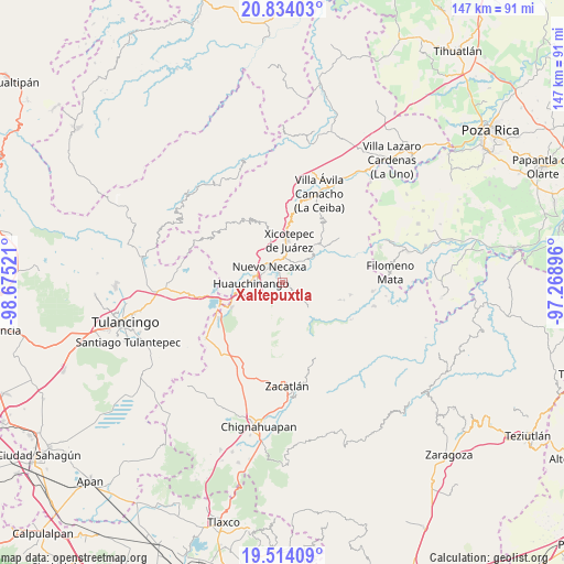
Xaltepuxtla GPS coordinates[2]
20° 10' 31.656" North, 97° 58' 19.488" West
| Map corner | latitude | longitude |
|---|---|---|
| Upper-left | 20.83403°, | -98.67521° |
| Center: | 20.17546°, | -97.97208° |
| Lower-right: | 19.51409°, | -97.26896° |
| Map W x H: | 146.8×146.8 km | = 91.2×91.2mi |
| max Lat: | 32.7° ⇑39.2% North |
| Xaltepuxtla: | 20.17546° |
| min Lat: | ⇓60.8% South 14.53588° |
| min Long | Xaltepuxtla | max Long |
| -117.105° | -97.97208° | -86.73105° |
| W 63.9%⇐ | ⇒36.1% E |
Elevation
Elevation of Xaltepuxtla is 1331 m = 4367 ft, and this is 77.3 m = 254 ft above average elevation for this country.
| Max E: |
3497 m = 11473 ft | 52.1% |
| Xaltepuxtla | 1331 m 4367 ft | |
| Avg. | 1253.7 m = 4113 ft | |
Min E: |
-1 m = -3 ft | 47.9% |
See also: Mexico elevation on elevation.city.
Geographical zone
Xaltepuxtla is located in North Torrid zone (between Equator and Tropic of Cancer). Distance of this Northern Tropic circle is 362.6 km =225.3 mi to North.| Distance of | km | miles | from Xaltepuxtla |
|---|---|---|---|
| North Pole | 7763.8 | 4824.2 | to North |
| Arctic Circle | 5157.9 | 3205 | to North |
| Tropic Cancer | 362.6 | 225.3 | to North |
| Equator | 2243.3 | 1393.9 | to South |


Nearby cities:
15 places around Xaltepuxtla: (largest is in red/bold)
• Ahuacatlán
5.6 km =3.5 mi,  221°
221°
• Chicahuaxtla
4.6 km =2.9 mi,  142°
142°
• Cuautlita
5.7 km =3.5 mi,  294°
294°
• Las Colonias de Hidalgo
2.3 km =1.4 mi,  348°
348°
• Necaxa
5.9 km =3.7 mi,  314°
314°
• Nuevo Necaxa
5.3 km =3.3 mi,  317°
317°
• Papatlazolco
2.1 km =1.3 mi,  276°
276°
• Quamila
5.7 km =3.5 mi,  100°
100°
• San Lorenzo Tlaxipehuala
5 km =3.1 mi,  181°
181°
• Tenango de las Flores
3.8 km =2.4 mi,  333°
333°
• Tlalmaya
2.3 km =1.4 mi,  214°
214°
• Tlatlapanala
4.5 km =2.8 mi,  93°
93°
• Tzahuinco
4 km =2.5 mi, 317°
• Tzitzicazapa
4.7 km =2.9 mi,  49°
49°
• Xaltepec
3.3 km =2.1 mi,  249°
249°
Sources, notices
• [Note1] Compared only with cities in Mexico existing in our database
• [Src1] Map data: © OpenStreetMap contributors (CC-BY-SA)
• [Src2] Other city data from geonames.org with taken over terms of usage.
• [Src3] Geographical zone / Annual Mean Temperature by Robert A. Rohde @ Wikipedia
