Tzahuinco geodata
Tzahuinco (Puebla) is a populated place; located in Mexico in America/Mexico_City (GMT-6) time zone. With population of 704 people, there are 12362 cities with bigger population in this country. Compared to other cities in Mexico, 61.4% of cities are located further ↓South; 63.6% of cities are located further ←West and 52.4% of cities have higher elevation than Tzahuinco. Note1


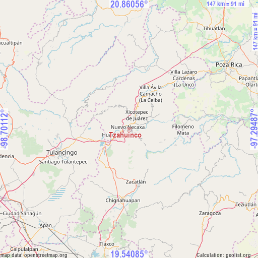
Tzahuinco GPS coordinates[2]
20° 12' 7.56" North, 97° 59' 52.764" West
| Map corner | latitude | longitude |
|---|---|---|
| Upper-left | 20.86056°, | -98.70112° |
| Center: | 20.2021°, | -97.99799° |
| Lower-right: | 19.54085°, | -97.29487° |
| Map W x H: | 146.7×146.7 km | = 91.2×91.2mi |
| max Lat: | 32.7° ⇑38.6% North |
| Tzahuinco: | 20.2021° |
| min Lat: | ⇓61.4% South 14.53588° |
| min Long | Tzahuinco | max Long |
| -117.105° | -97.99799° | -86.73105° |
| W 63.6%⇐ | ⇒36.4% E |
Elevation
Elevation of Tzahuinco is 1320 m = 4331 ft, and this is 66.3 m = 218 ft above average elevation for this country.
| Max E: |
3497 m = 11473 ft | 52.4% |
| Tzahuinco | 1320 m 4331 ft | |
| Avg. | 1253.7 m = 4113 ft | |
Min E: |
-1 m = -3 ft | 47.6% |
See also: Mexico elevation on elevation.city.
Geographical zone
Tzahuinco is located in North Torrid zone (between Equator and Tropic of Cancer). Distance of this Northern Tropic circle is 359.7 km =223.5 mi to North.| Distance of | km | miles | from Tzahuinco |
|---|---|---|---|
| North Pole | 7760.8 | 4822.3 | to North |
| Arctic Circle | 5154.9 | 3203.1 | to North |
| Tropic Cancer | 359.7 | 223.5 | to North |
| Equator | 2246.3 | 1395.8 | to South |


Nearby cities:
15 places around Tzahuinco: (largest is in red/bold)
• Cuacuila
4.8 km =3 mi,  226°
226°
• Cuautlita
2.6 km =1.6 mi,  257°
257°
• Cuaxicala
5.1 km =3.2 mi,  323°
323°
• Lagunillas
6 km =3.7 mi,  66°
66°
• Las Colonias de Hidalgo
2.3 km =1.4 mi,  106°
106°
• Necaxa
1.9 km =1.2 mi,  309°
309°
• Necaxaltépetl
3.7 km =2.3 mi,  2°
2°
• Nuevo Necaxa
1.3 km =0.8 mi, 316°
• Papatlazolco
2.8 km =1.7 mi,  166°
166°
• Patoltecoya
3.5 km =2.2 mi,  280°
280°
• Tenango de las Flores
1.1 km =0.7 mi, 68°
• Tierra Negra
6.3 km =3.9 mi,  43°
43°
• Tlalmaya
5.1 km =3.2 mi,  164°
164°
• Xaltepec
4.1 km =2.5 mi,  184°
184°
• Xaltepuxtla
4 km =2.5 mi,  137°
137°
Sources, notices
• [Note1] Compared only with cities in Mexico existing in our database
• [Src1] Map data: © OpenStreetMap contributors (CC-BY-SA)
• [Src2] Other city data from geonames.org with taken over terms of usage.
• [Src3] Geographical zone / Annual Mean Temperature by Robert A. Rohde @ Wikipedia
