San Lorenzo Tlaxipehuala geodata
San Lorenzo Tlaxipehuala (Puebla) is a populated place; located in Mexico in America/Mexico_City (GMT-6) time zone. With population of 1,966 people, there are 4435 cities with bigger population in this country. Compared to other cities in Mexico, 59.8% of cities are located further ↓South; 63.9% of cities are located further ←West and 59.7% of cities have lower elevation than San Lorenzo Tlaxipehuala. Note1
Current local time in San Lorenzo Tlaxipehuala:
06:51 AM, WednesdayDifference from your time zone: hours


San Lorenzo Tlaxipehuala GPS coordinates[2]
20° 7' 49.008" North, 97° 58' 24.996" West
| Map corner | latitude | longitude |
|---|---|---|
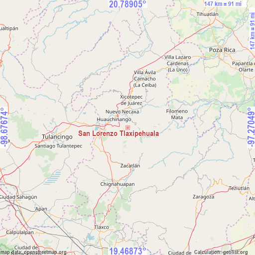
| Upper-left | 20.78905°, | -98.67674° |
| Center: | 20.13028°, | -97.97361° |
| Lower-right: | 19.46873°, | -97.27049° |
| Map W x H: | 146.8×146.8 km | = 91.2×91.2mi |
| max Lat: | 32.7° ⇑40.2% North |
| San Lorenzo Tlaxipehuala: | 20.13028° |
| min Lat: | ⇓59.8% South 14.53588° |
| min Long | San Lorenzo Tla | max Long |
| -117.105° | -97.97361° | -86.73105° |
| W 63.9%⇐ | ⇒36.1% E |
Elevation
Elevation of San Lorenzo Tlaxipehuala is 1721 m = 5646 ft, and this is 467.3 m = 1533 ft above average elevation for this country.
| Max E: |
3497 m = 11473 ft | 40.3% |
| San Lorenzo Tlaxipehuala | 1721 m 5646 ft | |
| Avg. | 1253.7 m = 4113 ft | |
Min E: |
-1 m = -3 ft | 59.7% |
See also: Mexico elevation on elevation.city.
Geographical zone
San Lorenzo Tlaxipehuala is located in North Torrid zone (between Equator and Tropic of Cancer). Distance of this Northern Tropic circle is 367.6 km =228.4 mi to North.| Distance of | km | miles | from San Lorenzo Tlaxipehuala |
|---|---|---|---|
| North Pole | 7768.8 | 4827.3 | to North |
| Arctic Circle | 5162.9 | 3208.1 | to North |
| Tropic Cancer | 367.6 | 228.4 | to North |
| Equator | 2238.3 | 1390.8 | to South |


Nearby cities:
15 places around San Lorenzo Tlaxipehuala: (largest is in red/bold)
• Ahuacatlán
3.6 km =2.2 mi,  282°
282°
• Chicahuaxtla
3.2 km =2 mi,  65°
65°
• Chiconcuautla
5.3 km =3.3 mi,  137°
137°
• Ocpaco
6.6 km =4.1 mi,  285°
285°
• Palzoquitla
1.6 km =1 mi,  187°
187°
• Papatlazolco
5.6 km =3.5 mi,  340°
340°
• Quamila
7 km =4.3 mi,  55°
55°
• Tlalmaya
3.3 km =2.1 mi, 339°
• Tlaltenango
1.9 km =1.2 mi, 136°
• Tlaola
5.4 km =3.4 mi,  80°
80°
• Tlatlapanala
6.7 km =4.2 mi,  44°
44°
• Xaltepec
4.8 km =3 mi,  323°
323°
• Xaltepuxtla
5 km =3.1 mi,  1°
1°
• Xilocuautla
5.3 km =3.3 mi, 281°
• Zempoala
5.5 km =3.4 mi,  208°
208°
Sources, notices
• [Note1] Compared only with cities in Mexico existing in our database
• [Src1] Map data: © OpenStreetMap contributors (CC-BY-SA)
• [Src2] Other city data from geonames.org with taken over terms of usage.
• [Src3] Geographical zone / Annual Mean Temperature by Robert A. Rohde @ Wikipedia
