Tlatlapanala geodata
Tlatlapanala (Puebla) is a populated place; located in Mexico in America/Mexico_City (GMT-6) time zone. With population of 780 people, there are 11196 cities with bigger population in this country. Compared to other cities in Mexico, 60.8% of cities are located further ↓South; 64.5% of cities are located further ←West and 54.2% of cities have higher elevation than Tlatlapanala. Note1


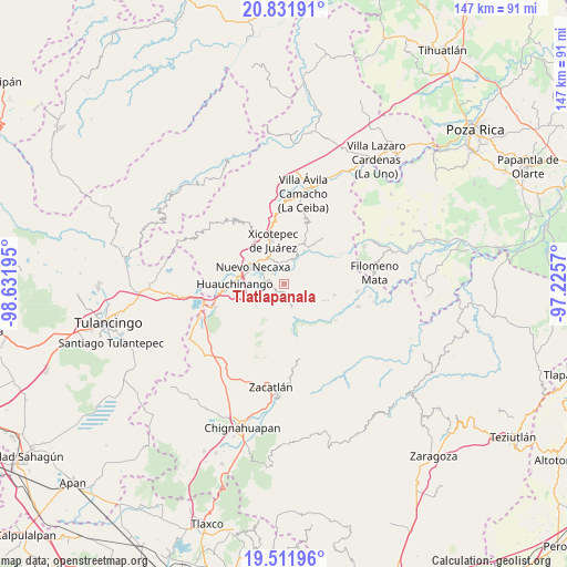
Tlatlapanala GPS coordinates[2]
20° 10' 23.988" North, 97° 55' 43.752" West
| Map corner | latitude | longitude |
|---|---|---|
| Upper-left | 20.83191°, | -98.63195° |
| Center: | 20.17333°, | -97.92882° |
| Lower-right: | 19.51196°, | -97.2257° |
| Map W x H: | 146.8×146.8 km | = 91.2×91.2mi |
| max Lat: | 32.7° ⇑39.2% North |
| Tlatlapanala: | 20.17333° |
| min Lat: | ⇓60.8% South 14.53588° |
| min Long | Tlatlapanala | max Long |
| -117.105° | -97.92882° | -86.73105° |
| W 64.5%⇐ | ⇒35.5% E |
Elevation
Elevation of Tlatlapanala is 1232 m = 4042 ft, and this is 21.7 m = 71 ft below average elevation for this country.
| Max E: |
3497 m = 11473 ft | 54.2% |
| Avg. | 1253.7 m = 4113 ft | |
| Tlatlapanala | 1232 m = 4042 ft | |
Min E: |
-1 m = -3 ft | 45.8% |
See also: Mexico elevation on elevation.city.
Geographical zone
Tlatlapanala is located in North Torrid zone (between Equator and Tropic of Cancer). Distance of this Northern Tropic circle is 362.9 km =225.5 mi to North.| Distance of | km | miles | from Tlatlapanala |
|---|---|---|---|
| North Pole | 7764 | 4824.3 | to North |
| Arctic Circle | 5158.1 | 3205.1 | to North |
| Tropic Cancer | 362.9 | 225.5 | to North |
| Equator | 2243.1 | 1393.8 | to South |


Nearby cities:
15 places around Tlatlapanala: (largest is in red/bold)
• Chicahuaxtla
3.8 km =2.4 mi,  207°
207°
• Lagunillas
5.9 km =3.7 mi,  343°
343°
• Las Colonias de Hidalgo
5.6 km =3.5 mi,  296°
296°
• Los Pinos
5.8 km =3.6 mi,  355°
355°
• Mazacoatlán
5.8 km =3.6 mi,  7°
7°
• Papatlazolco
6.6 km =4.1 mi,  274°
274°
• Quamila
1.3 km =0.8 mi,  126°
126°
• San Lorenzo Tlaxipehuala
6.7 km =4.2 mi,  224°
224°
• Telolotla
4.8 km =3 mi,  22°
22°
• Tlalmaya
6.1 km =3.8 mi,  253°
253°
• Tlaltepango
6.2 km =3.9 mi,  120°
120°
• Tlaola
3.9 km =2.4 mi,  171°
171°
• Tzitzicazapa
3.5 km =2.2 mi, 344°
• Xaltepuxtla
4.5 km =2.8 mi, 273°
• Xochinanacatlán
4 km =2.5 mi,  53°
53°
Sources, notices
• [Note1] Compared only with cities in Mexico existing in our database
• [Src1] Map data: © OpenStreetMap contributors (CC-BY-SA)
• [Src2] Other city data from geonames.org with taken over terms of usage.
• [Src3] Geographical zone / Annual Mean Temperature by Robert A. Rohde @ Wikipedia
