Tula de Allende geodata
Tula de Allende (Hidalgo) is a populated place; located in Mexico in America/Mexico_City (GMT-6) time zone. With population of 28,577 people, there are 348 cities with bigger population in this country. Compared to other cities in Mexico, 58% of cities are located further ↓South; 54.8% of cities are located further →East and 76.9% of cities have lower elevation than Tula de Allende. Note1


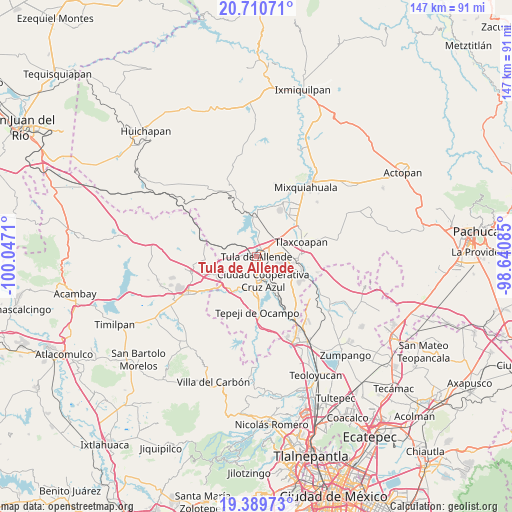
Tula de Allende GPS coordinates[2]
20° 3' 5.796" North, 99° 20' 38.292" West
| Map corner | latitude | longitude |
|---|---|---|
| Upper-left | 20.71071°, | -100.0471° |
| Center: | 20.05161°, | -99.34397° |
| Lower-right: | 19.38973°, | -98.64085° |
| Map W x H: | 146.9×146.9 km | = 91.3×91.3mi |
| max Lat: | 32.7° ⇑42% North |
| Tula de Allende: | 20.05161° |
| min Lat: | ⇓58% South 14.53588° |
| min Long | Tula de Allende | max Long |
| -117.105° | -99.34397° | -86.73105° |
| W 45.2%⇐ | ⇒54.8% E |
Elevation
Elevation of Tula de Allende is 2066 m = 6778 ft, and this is 812.3 m = 2665 ft above average elevation for this country.
| Max E: |
3497 m = 11473 ft | 23.1% |
| Tula de Allende | 2066 m 6778 ft | |
| Avg. | 1253.7 m = 4113 ft | |
Min E: |
-1 m = -3 ft | 76.9% |
See also: Mexico elevation on elevation.city.
Geographical zone
Tula de Allende is located in North Torrid zone (between Equator and Tropic of Cancer). Distance of this Northern Tropic circle is 376.4 km =233.9 mi to North.| Distance of | km | miles | from Tula de Allende |
|---|---|---|---|
| North Pole | 7777.5 | 4832.7 | to North |
| Arctic Circle | 5171.6 | 3213.5 | to North |
| Tropic Cancer | 376.4 | 233.9 | to North |
| Equator | 2229.5 | 1385.3 | to South |


Nearby cities:
15 places around Tula de Allende: (largest is in red/bold)
• Colonia Benito Juárez
6.1 km =3.8 mi,  3°
3°
• Colonia Nueva Santa María
6 km =3.7 mi,  187°
187°
• Colonia Sesenta y Dos
5.2 km =3.2 mi,  182°
182°
• El Crestón
2.6 km =1.6 mi,  295°
295°
• El Llano
3 km =1.9 mi,  58°
58°
• Ignacio Zaragoza
4.7 km =2.9 mi,  148°
148°
• La Amistad
5.4 km =3.4 mi, 152°
• Nantzha
2.6 km =1.6 mi,  273°
273°
• Residencial Arboledas
4.6 km =2.9 mi,  72°
72°
• San Andrés
3.8 km =2.4 mi, 274°
• San Ildefonso
6.8 km =4.2 mi,  205°
205°
• San Marcos
2.5 km =1.6 mi,  159°
159°
• San Miguel Vindho
6.9 km =4.3 mi, 156°
• Santa María Ilucan
6.6 km =4.1 mi, 175°
• Xiteje de Zapata
6.9 km =4.3 mi,  317°
317°
Sources, notices
• [Note1] Compared only with cities in Mexico existing in our database
• [Src1] Map data: © OpenStreetMap contributors (CC-BY-SA)
• [Src2] Other city data from geonames.org with taken over terms of usage.
• [Src3] Geographical zone / Annual Mean Temperature by Robert A. Rohde @ Wikipedia
