El Llano geodata
El Llano (Hidalgo) is a populated place; located in Mexico in America/Mexico_City (GMT-6) time zone. With population of 14,559 people, there are 664 cities with bigger population in this country. Compared to other cities in Mexico, 58.5% of cities are located further ↓South; 54.4% of cities are located further →East and 77.9% of cities have lower elevation than El Llano. Note1


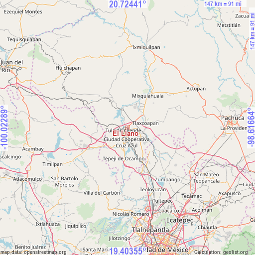
El Llano GPS coordinates[2]
20° 3' 55.332" North, 99° 19' 11.136" West
| Map corner | latitude | longitude |
|---|---|---|
| Upper-left | 20.72441°, | -100.02289° |
| Center: | 20.06537°, | -99.31976° |
| Lower-right: | 19.40355°, | -98.61664° |
| Map W x H: | 146.9×146.9 km | = 91.3×91.3mi |
| max Lat: | 32.7° ⇑41.5% North |
| El Llano: | 20.06537° |
| min Lat: | ⇓58.5% South 14.53588° |
| min Long | El Llano | max Long |
| -117.105° | -99.31976° | -86.73105° |
| W 45.6%⇐ | ⇒54.4% E |
Elevation
Elevation of El Llano is 2086 m = 6844 ft, and this is 832.3 m = 2731 ft above average elevation for this country.
| Max E: |
3497 m = 11473 ft | 22.1% |
| El Llano | 2086 m 6844 ft | |
| Avg. | 1253.7 m = 4113 ft | |
Min E: |
-1 m = -3 ft | 77.9% |
See also: Mexico elevation on elevation.city.
Geographical zone
El Llano is located in North Torrid zone (between Equator and Tropic of Cancer). Distance of this Northern Tropic circle is 374.9 km =233 mi to North.| Distance of | km | miles | from El Llano |
|---|---|---|---|
| North Pole | 7776 | 4831.8 | to North |
| Arctic Circle | 5170.1 | 3212.6 | to North |
| Tropic Cancer | 374.9 | 233 | to North |
| Equator | 2231.1 | 1386.3 | to South |


Nearby cities:
15 places around El Llano: (largest is in red/bold)
• Bomintzha
7.5 km =4.7 mi,  139°
139°
• Colonia Benito Juárez
5 km =3.1 mi,  335°
335°
• Colonia Sesenta y Dos
7.2 km =4.5 mi,  202°
202°
• El Crestón
4.9 km =3 mi,  265°
265°
• Ignacio Zaragoza
5.5 km =3.4 mi,  181°
181°
• La Amistad
6.3 km =3.9 mi, 180°
• Nantzha
5.3 km =3.3 mi,  255°
255°
• Residencial Arboledas
1.9 km =1.2 mi,  93°
93°
• San Andrés
6.4 km =4 mi, 259°
• San Marcos
4.2 km =2.6 mi, 202°
• San Miguel Vindho
7.9 km =4.9 mi, 178°
• Santa Ana Ahuehuepan
6.9 km =4.3 mi, 337°
• Teocalco
4.5 km =2.8 mi,  59°
59°
• Tula de Allende
3 km =1.9 mi,  238°
238°
• Xiteje de Zapata
8 km =5 mi,  296°
296°
Sources, notices
• [Note1] Compared only with cities in Mexico existing in our database
• [Src1] Map data: © OpenStreetMap contributors (CC-BY-SA)
• [Src2] Other city data from geonames.org with taken over terms of usage.
• [Src3] Geographical zone / Annual Mean Temperature by Robert A. Rohde @ Wikipedia
