Acatlán de Osorio geodata
Acatlán de Osorio (Puebla) is a populated place; located in Mexico in America/Mexico_City (GMT-6) time zone. With population of 16,307 people, there are 587 cities with bigger population in this country. Compared to other cities in Mexico, 76.2% of cities are located further ↑North; 63% of cities are located further ←West and 55.3% of cities have higher elevation than Acatlán de Osorio. Note1


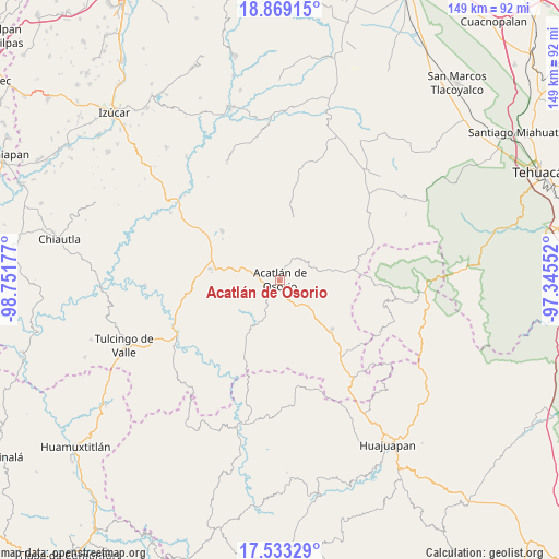
Acatlán de Osorio GPS coordinates[2]
18° 12' 9" North, 98° 2' 55.104" West
| Map corner | latitude | longitude |
|---|---|---|
| Upper-left | 18.86915°, | -98.75177° |
| Center: | 18.2025°, | -98.04864° |
| Lower-right: | 17.53329°, | -97.34552° |
| Map W x H: | 148.5×148.5 km | = 92.3×92.3mi |
| max Lat: | 32.7° ⇑76.2% North |
| Acatlán de Osorio: | 18.2025° |
| min Lat: | ⇓23.8% South 14.53588° |
| min Long | Acatlán de Oso | max Long |
| -117.105° | -98.04864° | -86.73105° |
| W 63%⇐ | ⇒37% E |
Elevation
Elevation of Acatlán de Osorio is 1185 m = 3888 ft, and this is 68.7 m = 225 ft below average elevation for this country.
| Max E: |
3497 m = 11473 ft | 55.3% |
| Avg. | 1253.7 m = 4113 ft | |
| Acatlán de Osorio | 1185 m = 3888 ft | |
Min E: |
-1 m = -3 ft | 44.7% |
See also: Mexico elevation on elevation.city.
Geographical zone
Acatlán de Osorio is located in North Torrid zone (between Equator and Tropic of Cancer). Distance of this Northern Tropic circle is 582 km =361.6 mi to North.| Distance of | km | miles | from Acatlán de Osorio |
|---|---|---|---|
| North Pole | 7983.1 | 4960.5 | to North |
| Arctic Circle | 5377.2 | 3341.2 | to North |
| Tropic Cancer | 582 | 361.6 | to North |
| Equator | 2023.9 | 1257.6 | to South |


Nearby cities:
15 places around Acatlán de Osorio: (largest is in red/bold)
• Amatitlán de Azueta
4.1 km =2.5 mi,  225°
225°
• Gabino Barreda
10.9 km =6.8 mi,  109°
109°
• Garzones (Santa Gertrudis)
8.7 km =5.4 mi,  13°
13°
• Hermenegildo Galeana
8.3 km =5.2 mi,  316°
316°
• La Huerta
7.2 km =4.5 mi,  32°
32°
• Las Nieves
2.1 km =1.3 mi,  172°
172°
• Mixquitlixco
8.1 km =5 mi,  206°
206°
• San Bernardo
6.1 km =3.8 mi,  280°
280°
• San Francisco Rancho Nuevo
6.5 km =4 mi,  348°
348°
• San Pablo Anicano
9.5 km =5.9 mi,  203°
203°
• San Pedro Yeloixtlahuacan
10 km =6.2 mi, 197°
• San Vicente Boquerón
8.6 km =5.3 mi,  355°
355°
• Tetelcingo
4.7 km =2.9 mi, 29°
• Tianguistengo
6.7 km =4.2 mi, 30°
• Xayacatlán de Bravo
8.7 km =5.4 mi,  63°
63°
Sources, notices
• [Note1] Compared only with cities in Mexico existing in our database
• [Src1] Map data: © OpenStreetMap contributors (CC-BY-SA)
• [Src2] Other city data from geonames.org with taken over terms of usage.
• [Src3] Geographical zone / Annual Mean Temperature by Robert A. Rohde @ Wikipedia
