Tlaxmalac geodata
Tlaxmalac (Guerrero) is a populated place; located in Mexico in America/Mexico_City (GMT-6) time zone. With population of 2,217 people, there are 3960 cities with bigger population in this country. Compared to other cities in Mexico, 74.2% of cities are located further ↑North; 55.7% of cities are located further →East and 61.8% of cities have higher elevation than Tlaxmalac. Note1


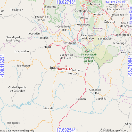
Tlaxmalac GPS coordinates[2]
18° 21' 40.14" North, 99° 24' 47.376" West
| Map corner | latitude | longitude |
|---|---|---|
| Upper-left | 19.02718°, | -100.11629° |
| Center: | 18.36115°, | -99.41316° |
| Lower-right: | 17.69254°, | -98.71004° |
| Map W x H: | 148.4×148.4 km | = 92.2×92.2mi |
| max Lat: | 32.7° ⇑74.2% North |
| Tlaxmalac: | 18.36115° |
| min Lat: | ⇓25.8% South 14.53588° |
| min Long | Tlaxmalac | max Long |
| -117.105° | -99.41316° | -86.73105° |
| W 44.3%⇐ | ⇒55.7% E |
Elevation
Elevation of Tlaxmalac is 893 m = 2930 ft, and this is 360.7 m = 1183 ft below average elevation for this country.
| Max E: |
3497 m = 11473 ft | 61.8% |
| Avg. | 1253.7 m = 4113 ft | |
| Tlaxmalac | 893 m = 2930 ft | |
Min E: |
-1 m = -3 ft | 38.2% |
See also: Mexico elevation on elevation.city.
Geographical zone
Tlaxmalac is located in North Torrid zone (between Equator and Tropic of Cancer). Distance of this Northern Tropic circle is 564.4 km =350.7 mi to North.| Distance of | km | miles | from Tlaxmalac |
|---|---|---|---|
| North Pole | 7965.5 | 4949.5 | to North |
| Arctic Circle | 5359.6 | 3330.3 | to North |
| Tropic Cancer | 564.4 | 350.7 | to North |
| Equator | 2041.6 | 1268.6 | to South |


Nearby cities:
15 places around Tlaxmalac: (largest is in red/bold)
• Atetetla
5.6 km =3.5 mi,  130°
130°
• Buenavista de Cuéllar
11 km =6.8 mi,  2°
2°
• Ciudad de Huitzuco
10.6 km =6.6 mi, 127°
• Colonia 15 de Septiembre
11.9 km =7.4 mi,  279°
279°
• Colonia Francisco Villa
11.8 km =7.3 mi, 281°
• Colonia Rancho del Cura (El Cura)
12.8 km =8 mi,  234°
234°
• Cuexcontlán
6.5 km =4 mi,  195°
195°
• El Naranjo
13.5 km =8.4 mi,  288°
288°
• Iguala de la Independencia
13.6 km =8.5 mi,  262°
262°
• Pololcingo
9.2 km =5.7 mi,  166°
166°
• San Vicente Palapa
4.1 km =2.5 mi,  176°
176°
• Tepecoacuilco de Trujano
9.8 km =6.1 mi,  213°
213°
• Tepochica
13.4 km =8.3 mi,  240°
240°
• Tierra Colorada
12.3 km =7.6 mi, 213°
• Tuxpan
7.1 km =4.4 mi, 259°
Sources, notices
• [Note1] Compared only with cities in Mexico existing in our database
• [Src1] Map data: © OpenStreetMap contributors (CC-BY-SA)
• [Src2] Other city data from geonames.org with taken over terms of usage.
• [Src3] Geographical zone / Annual Mean Temperature by Robert A. Rohde @ Wikipedia
