El Naranjo geodata
El Naranjo (Guerrero) is a populated place; located in Mexico in America/Mexico_City (GMT-6) time zone. With population of 870 people, there are 10041 cities with bigger population in this country. Compared to other cities in Mexico, 73.8% of cities are located further ↑North; 57.4% of cities are located further →East and 62.8% of cities have higher elevation than El Naranjo. Note1


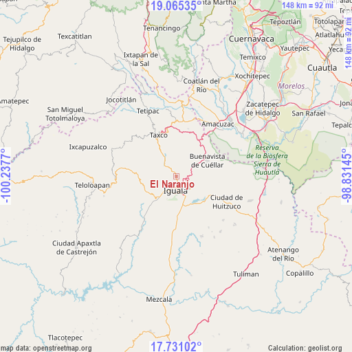
El Naranjo GPS coordinates[2]
18° 23' 58.128" North, 99° 32' 4.452" West
| Map corner | latitude | longitude |
|---|---|---|
| Upper-left | 19.06535°, | -100.2377° |
| Center: | 18.39948°, | -99.53457° |
| Lower-right: | 17.73102°, | -98.83145° |
| Map W x H: | 148.4×148.4 km | = 92.2×92.2mi |
| max Lat: | 32.7° ⇑73.8% North |
| El Naranjo: | 18.39948° |
| min Lat: | ⇓26.2% South 14.53588° |
| min Long | El Naranjo | max Long |
| -117.105° | -99.53457° | -86.73105° |
| W 42.6%⇐ | ⇒57.4% E |
Elevation
Elevation of El Naranjo is 830 m = 2723 ft, and this is 423.7 m = 1390 ft below average elevation for this country.
| Max E: |
3497 m = 11473 ft | 62.8% |
| Avg. | 1253.7 m = 4113 ft | |
| El Naranjo | 830 m = 2723 ft | |
Min E: |
-1 m = -3 ft | 37.2% |
See also: Mexico elevation on elevation.city.
Geographical zone
El Naranjo is located in North Torrid zone (between Equator and Tropic of Cancer). Distance of this Northern Tropic circle is 560.1 km =348 mi to North.| Distance of | km | miles | from El Naranjo |
|---|---|---|---|
| North Pole | 7961.2 | 4946.9 | to North |
| Arctic Circle | 5355.3 | 3327.6 | to North |
| Tropic Cancer | 560.1 | 348 | to North |
| Equator | 2045.8 | 1271.2 | to South |


Nearby cities:
15 places around El Naranjo: (largest is in red/bold)
• Ceja Blanca
12.1 km =7.5 mi,  193°
193°
• Colonia 15 de Septiembre
2.6 km =1.6 mi,  154°
154°
• Colonia Francisco Villa
2.4 km =1.5 mi, 148°
• Colonia Rancho del Cura (El Cura)
12 km =7.5 mi,  168°
168°
• Coxcatlán
13.2 km =8.2 mi,  36°
36°
• Fermín Rabadán Cervantes
10 km =6.2 mi,  200°
200°
• Iguala de la Independencia
6.1 km =3.8 mi, 186°
• Metlapa
12.7 km =7.9 mi,  218°
218°
• Mexcaltepec
2.4 km =1.5 mi,  332°
332°
• Puente Campuzano
8 km =5 mi,  315°
315°
• Taxco el Viejo
10.7 km =6.6 mi, 330°
• Tecalpulco
12.2 km =7.6 mi, 323°
• Tepochica
10.8 km =6.7 mi, 174°
• Tlamacazapa
11.4 km =7.1 mi,  18°
18°
• Tuxpan
8 km =5 mi,  133°
133°
Sources, notices
• [Note1] Compared only with cities in Mexico existing in our database
• [Src1] Map data: © OpenStreetMap contributors (CC-BY-SA)
• [Src2] Other city data from geonames.org with taken over terms of usage.
• [Src3] Geographical zone / Annual Mean Temperature by Robert A. Rohde @ Wikipedia
