Tlaxco geodata
Tlaxco (Hidalgo) is a populated place; located in Mexico in America/Mexico_City (GMT-6) time zone. With population of 602 people, there are 14290 cities with bigger population in this country. Compared to other cities in Mexico, 71.8% of cities are located further ↓South; 53.4% of cities are located further ←West and 57.7% of cities have lower elevation than Tlaxco. Note1


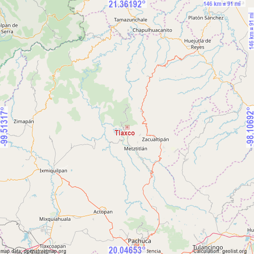
Tlaxco GPS coordinates[2]
20° 42' 20.34" North, 98° 48' 36.144" West
| Map corner | latitude | longitude |
|---|---|---|
| Upper-left | 21.36192°, | -99.51317° |
| Center: | 20.70565°, | -98.81004° |
| Lower-right: | 20.04653°, | -98.10692° |
| Map W x H: | 146.3×146.3 km | = 90.9×90.9mi |
| max Lat: | 32.7° ⇑28.2% North |
| Tlaxco: | 20.70565° |
| min Lat: | ⇓71.8% South 14.53588° |
| min Long | Tlaxco | max Long |
| -117.105° | -98.81004° | -86.73105° |
| W 53.4%⇐ | ⇒46.6% E |
Elevation
Elevation of Tlaxco is 1683 m = 5522 ft, and this is 429.3 m = 1408 ft above average elevation for this country.
| Max E: |
3497 m = 11473 ft | 42.3% |
| Tlaxco | 1683 m 5522 ft | |
| Avg. | 1253.7 m = 4113 ft | |
Min E: |
-1 m = -3 ft | 57.7% |
See also: Mexico elevation on elevation.city.
Geographical zone
Tlaxco is located in North Torrid zone (between Equator and Tropic of Cancer). Distance of this Northern Tropic circle is 303.7 km =188.7 mi to North.| Distance of | km | miles | from Tlaxco |
|---|---|---|---|
| North Pole | 7704.8 | 4787.5 | to North |
| Arctic Circle | 5098.9 | 3168.3 | to North |
| Tropic Cancer | 303.7 | 188.7 | to North |
| Equator | 2302.3 | 1430.6 | to South |


Nearby cities:
15 places around Tlaxco: (largest is in red/bold)
• Alumbres
13.2 km =8.2 mi,  107°
107°
• Eloxochitlán
4.1 km =2.5 mi,  2°
2°
• Hualula
2.8 km =1.7 mi,  277°
277°
• Lototla
17.9 km =11.1 mi,  32°
32°
• Malila
9.7 km =6 mi,  73°
73°
• Metztitlán
13.3 km =8.3 mi,  158°
158°
• Molango
12.4 km =7.7 mi,  43°
43°
• Nonoalco
11.4 km =7.1 mi,  84°
84°
• San Cristóbal
7.5 km =4.7 mi,  195°
195°
• Santa María
17.4 km =10.8 mi,  336°
336°
• Santa Mónica
15.3 km =9.5 mi, 81°
• Tianguistengo
18.7 km =11.6 mi, 82°
• Tlatepexe
11.7 km =7.3 mi,  166°
166°
• Xochicoatlán
15.7 km =9.8 mi,  59°
59°
• Zacualtipán
17.1 km =10.6 mi, 111°
Sources, notices
• [Note1] Compared only with cities in Mexico existing in our database
• [Src1] Map data: © OpenStreetMap contributors (CC-BY-SA)
• [Src2] Other city data from geonames.org with taken over terms of usage.
• [Src3] Geographical zone / Annual Mean Temperature by Robert A. Rohde @ Wikipedia
