Xochicoatlán geodata
Xochicoatlán (Hidalgo) is a populated place; located in Mexico in America/Mexico_City (GMT-6) time zone. With population of 1,254 people, there are 6906 cities with bigger population in this country. Compared to other cities in Mexico, 72.9% of cities are located further ↓South; 55.3% of cities are located further ←West and 57.6% of cities have lower elevation than Xochicoatlán. Note1


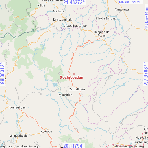
Xochicoatlán GPS coordinates[2]
20° 46' 36.336" North, 98° 40' 47.964" West
| Map corner | latitude | longitude |
|---|---|---|
| Upper-left | 21.43272°, | -99.38312° |
| Center: | 20.77676°, | -98.67999° |
| Lower-right: | 20.11794°, | -97.97687° |
| Map W x H: | 146.2×146.2 km | = 90.8×90.8mi |
| max Lat: | 32.7° ⇑27.1% North |
| Xochicoatlán: | 20.77676° |
| min Lat: | ⇓72.9% South 14.53588° |
| min Long | Xochicoatlán | max Long |
| -117.105° | -98.67999° | -86.73105° |
| W 55.3%⇐ | ⇒44.7% E |
Elevation
Elevation of Xochicoatlán is 1681 m = 5515 ft, and this is 427.3 m = 1402 ft above average elevation for this country.
| Max E: |
3497 m = 11473 ft | 42.4% |
| Xochicoatlán | 1681 m 5515 ft | |
| Avg. | 1253.7 m = 4113 ft | |
Min E: |
-1 m = -3 ft | 57.6% |
See also: Mexico elevation on elevation.city.
Geographical zone
Xochicoatlán is located in North Torrid zone (between Equator and Tropic of Cancer). Distance of this Northern Tropic circle is 295.8 km =183.8 mi to North.| Distance of | km | miles | from Xochicoatlán |
|---|---|---|---|
| North Pole | 7696.9 | 4782.6 | to North |
| Arctic Circle | 5091 | 3163.4 | to North |
| Tropic Cancer | 295.8 | 183.8 | to North |
| Equator | 2310.2 | 1435.5 | to South |


Nearby cities:
15 places around Xochicoatlán: (largest is in red/bold)
• Ahuacatlán
13.1 km =8.1 mi,  16°
16°
• Alumbres
12 km =7.5 mi,  184°
184°
• Coatlila
14 km =8.7 mi,  135°
135°
• Eloxochitlán
13.9 km =8.6 mi,  254°
254°
• Ixtlahuaca
12.1 km =7.5 mi,  348°
348°
• Lototla
8.2 km =5.1 mi,  331°
331°
• Malila
6.6 km =4.1 mi,  219°
219°
• Molango
5.2 km =3.2 mi,  282°
282°
• Nonoalco
7.1 km =4.4 mi,  197°
197°
• San Miguel
14.7 km =9.1 mi,  70°
70°
• Santa Mónica
5.8 km =3.6 mi,  164°
164°
• Soyatla
11.3 km =7 mi, 142°
• Texcaco
9.7 km =6 mi,  43°
43°
• Tianguistengo
7.4 km =4.6 mi, 137°
• Zacualtipán
14.3 km =8.9 mi,  170°
170°
Sources, notices
• [Note1] Compared only with cities in Mexico existing in our database
• [Src1] Map data: © OpenStreetMap contributors (CC-BY-SA)
• [Src2] Other city data from geonames.org with taken over terms of usage.
• [Src3] Geographical zone / Annual Mean Temperature by Robert A. Rohde @ Wikipedia
