Tilica geodata
Tilica (Veracruz) is a populated place; located in Mexico in America/Mexico_City (GMT-6) time zone. With population of 558 people, there are 15286 cities with bigger population in this country. Compared to other cities in Mexico, 72% of cities are located further ↑North; 77% of cities are located further ←West and 80.6% of cities have higher elevation than Tilica. Note1


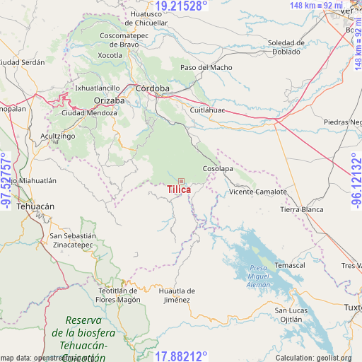
Tilica GPS coordinates[2]
18° 33' 0" North, 96° 49' 27.984" West
| Map corner | latitude | longitude |
|---|---|---|
| Upper-left | 19.21528°, | -97.52757° |
| Center: | 18.55°, | -96.82444° |
| Lower-right: | 17.88212°, | -96.12132° |
| Map W x H: | 148.2×148.2 km | = 92.1×92.1mi |
| max Lat: | 32.7° ⇑72% North |
| Tilica: | 18.55° |
| min Lat: | ⇓28% South 14.53588° |
| min Long | Tilica | max Long |
| -117.105° | -96.82444° | -86.73105° |
| W 77%⇐ | ⇒23% E |
Elevation
Elevation of Tilica is 86 m = 282 ft, and this is 1167.7 m = 3831 ft below average elevation for this country.
| Max E: |
3497 m = 11473 ft | 80.6% |
| Avg. | 1253.7 m = 4113 ft | |
| Tilica | 86 m = 282 ft | |
Min E: |
-1 m = -3 ft | 19.4% |
See also: Mexico elevation on elevation.city.
Geographical zone
Tilica is located in North Torrid zone (between Equator and Tropic of Cancer). Distance of this Northern Tropic circle is 543.4 km =337.7 mi to North.| Distance of | km | miles | from Tilica |
|---|---|---|---|
| North Pole | 7944.5 | 4936.5 | to North |
| Arctic Circle | 5338.6 | 3317.3 | to North |
| Tropic Cancer | 543.4 | 337.7 | to North |
| Equator | 2062.6 | 1281.6 | to South |


Nearby cities:
15 places around Tilica: (largest is in red/bold)
• Almilinga
4.1 km =2.5 mi,  120°
120°
• El Suspiro
10.6 km =6.6 mi,  152°
152°
• Laguna Chica (Pueblo Nuevo)
9.7 km =6 mi,  94°
94°
• Limonestitla
4.9 km =3 mi,  184°
184°
• Loma Bonita
6.1 km =3.8 mi,  228°
228°
• Palmar Grande
6.2 km =3.9 mi,  128°
128°
• Rancho Nuevo
5.1 km =3.2 mi,  97°
97°
• San Martín Mazateopan
10.8 km =6.7 mi, 175°
• Tentziantla (San Marcos)
9 km =5.6 mi, 177°
• Tepenacaxtla
9.6 km =6 mi,  295°
295°
• Tepepan
8.8 km =5.5 mi,  256°
256°
• Tepetlampa
3.3 km =2.1 mi,  187°
187°
• Villa Hermosa (Villa Nueva)
6.6 km =4.1 mi,  342°
342°
• Xonotipan de Juárez
10 km =6.2 mi, 230°
• Zapaltecatl
10.7 km =6.6 mi,  285°
285°
Sources, notices
• [Note1] Compared only with cities in Mexico existing in our database
• [Src1] Map data: © OpenStreetMap contributors (CC-BY-SA)
• [Src2] Other city data from geonames.org with taken over terms of usage.
• [Src3] Geographical zone / Annual Mean Temperature by Robert A. Rohde @ Wikipedia
