Xonotipan de Juárez geodata
Xonotipan de Juárez (Puebla) is a populated place; located in Mexico in America/Mexico_City (GMT-6) time zone. With population of 748 people, there are 11708 cities with bigger population in this country. Compared to other cities in Mexico, 72.7% of cities are located further ↑North; 76.1% of cities are located further ←West and 62.7% of cities have higher elevation than Xonotipan de Juárez. Note1


Xonotipan de Juárez GPS coordinates[2]
18° 29' 34.512" North, 96° 53' 50.352" West
| Map corner | latitude | longitude |
|---|---|---|
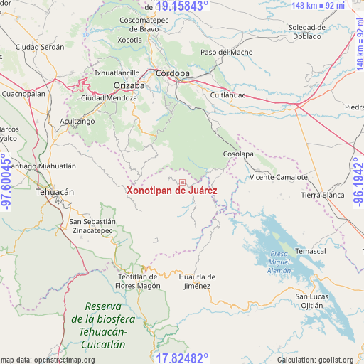
| Upper-left | 19.15843°, | -97.60045° |
| Center: | 18.49292°, | -96.89732° |
| Lower-right: | 17.82482°, | -96.1942° |
| Map W x H: | 148.3×148.3 km | = 92.1×92.1mi |
| max Lat: | 32.7° ⇑72.7% North |
| Xonotipan de Juárez: | 18.49292° |
| min Lat: | ⇓27.3% South 14.53588° |
| min Long | Xonotipan de Ju | max Long |
| -117.105° | -96.89732° | -86.73105° |
| W 76.1%⇐ | ⇒23.9% E |
Elevation
Elevation of Xonotipan de Juárez is 837 m = 2746 ft, and this is 416.7 m = 1367 ft below average elevation for this country.
| Max E: |
3497 m = 11473 ft | 62.7% |
| Avg. | 1253.7 m = 4113 ft | |
| Xonotipan de Juárez | 837 m = 2746 ft | |
Min E: |
-1 m = -3 ft | 37.3% |
See also: Mexico elevation on elevation.city.
Geographical zone
Xonotipan de Juárez is located in North Torrid zone (between Equator and Tropic of Cancer). Distance of this Northern Tropic circle is 549.7 km =341.6 mi to North.| Distance of | km | miles | from Xonotipan de Juárez |
|---|---|---|---|
| North Pole | 7950.8 | 4940.4 | to North |
| Arctic Circle | 5345 | 3321.2 | to North |
| Tropic Cancer | 549.7 | 341.6 | to North |
| Equator | 2056.2 | 1277.7 | to South |


Nearby cities:
15 places around Xonotipan de Juárez: (largest is in red/bold)
• Achichinalco
9.9 km =6.2 mi,  265°
265°
• Atexacapa
8.2 km =5.1 mi,  288°
288°
• Chiapa
5.8 km =3.6 mi,  240°
240°
• Coyolapa
8.8 km =5.5 mi,  170°
170°
• Eloxochitlán
6 km =3.7 mi,  277°
277°
• Huitzmaloc
6.1 km =3.8 mi,  228°
228°
• Limonestitla
7.4 km =4.6 mi,  78°
78°
• Loma Bonita
3.9 km =2.4 mi,  53°
53°
• Papaloapan
6.3 km =3.9 mi,  320°
320°
• San Martín Mazateopan
9.7 km =6 mi,  117°
117°
• Tentziantla (San Marcos)
8.5 km =5.3 mi,  108°
108°
• Tepepan
4.4 km =2.7 mi,  348°
348°
• Tepetlampa
7.9 km =4.9 mi,  67°
67°
• Tepetlampa
7.9 km =4.9 mi,  328°
328°
• Zapaltecatl
9.6 km =6 mi,  344°
344°
Sources, notices
• [Note1] Compared only with cities in Mexico existing in our database
• [Src1] Map data: © OpenStreetMap contributors (CC-BY-SA)
• [Src2] Other city data from geonames.org with taken over terms of usage.
• [Src3] Geographical zone / Annual Mean Temperature by Robert A. Rohde @ Wikipedia
